
IMAGES TAKEN NEAR TO
Rope Lane, CREWE, CW2 5DR
Introduction
This page details the photographs taken nearby to Rope Lane, CW2 5DR by members of the Geograph project.
The Geograph project started in 2005 with the aim of publishing, organising and preserving representative images for every square kilometre of Great Britain, Ireland and the Isle of Man.

There are currently over 7.5m images from over14,400 individuals and you can help contribute to the project by visiting https://www.geograph.org.uk
Image Map
Images are licensed for reuse under creativecommons.org/licenses/by-sa/2.0
Notes
- Clicking on the map will re-center to the selected point.
- The higher the marker number, the further away the image location is from the centre of the postcode.
Image Listing (21 Images Found)
Images are licensed for reuse under creativecommons.org/licenses/by-sa/2.0
Image
Details
Distance
1
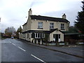
The Vine public house, Shavington
On Rope Lane.
Image: © JThomas
Taken: 12 Nov 2016
0.02 miles
2
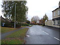
Rope Lane, Shavington
Looking north near the Vine public house.
Image: © JThomas
Taken: 12 Nov 2016
0.02 miles
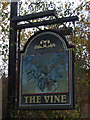
4
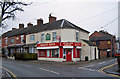
Bargain Booze, Shavington
Possibly not the most politically correct of names for an off-licence. The location is Main Street on the corner of Osborne Grove.
Image: © Richard Dorrell
Taken: 22 Jan 2011
0.12 miles
5
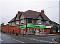
Shavington Co-op
Located in Main Street at its junction with Rope Lane.
Image: © Richard Dorrell
Taken: 22 Jan 2011
0.12 miles
6
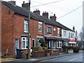
Bella Terrace, Shavington
A residential terrace in Main Road. There is barely a feature on any of these houses which has not been altered from the original - gardens, doors, windows, even the chimneys. So now, the once similar houses are all different!
Image: © Richard Dorrell
Taken: 22 Jan 2011
0.12 miles
7
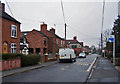
Main Road, Shavington
Looking east. The building just right of centre with the rendered upper storey is the Co-op store on the corner of Rope Lane.
Image: © Richard Dorrell
Taken: 22 Jan 2011
0.13 miles
8

Former chapel in Main Street
The building has an engraved stone in its gable which reads: 'Christs Free Gospel Chapel 1871'. The building now appears to be in use as a public hall.
Image: © Richard Dorrell
Taken: 22 Jan 2011
0.15 miles
9
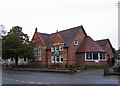
Shavington cum Gresty Village Hall
Located in Main Road. The building is dated 1900.
Image: © Richard Dorrell
Taken: 22 Jan 2011
0.16 miles
10
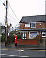
Shavington Post Office
Located in Main Street, and occupying on half of a residential semi-detached house.
Image: © Richard Dorrell
Taken: 22 Jan 2011
0.16 miles