
IMAGES TAKEN NEAR TO
Oakley, KENILWORTH, CV8 1QE
Introduction
This page details the photographs taken nearby to Oakley, CV8 1QE by members of the Geograph project.
The Geograph project started in 2005 with the aim of publishing, organising and preserving representative images for every square kilometre of Great Britain, Ireland and the Isle of Man.

There are currently over 7.5m images from over14,400 individuals and you can help contribute to the project by visiting https://www.geograph.org.uk
Image Map
Images are licensed for reuse under creativecommons.org/licenses/by-sa/2.0
Notes
- Clicking on the map will re-center to the selected point.
- The higher the marker number, the further away the image location is from the centre of the postcode.
Image Listing (15 Images Found)
Images are licensed for reuse under creativecommons.org/licenses/by-sa/2.0
Image
Details
Distance
1
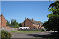
Houses, Oakley
Oakley is the road name of a small isolated housing estate off Oldwich Lane East – perhaps former County Council rural housing or built for the servicemen based at the adjacent Honiley airfield.
Image: © Robin Stott
Taken: 22 May 2010
0.03 miles
2
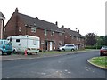
Fen End
The small cluster of houses at Fen End were originally associated with the RAF station connected to the nearby airfield. There is now no military involvement and the airfield is an automotive proving ground belonging to Prodrive.
Image: © Nigel Mykura
Taken: 28 Apr 2011
0.05 miles
3
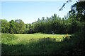
Mowing buttercups
A meadow in the southern angle of Oldwich Lane East and Honiley Road.
Image: © Robin Stott
Taken: 22 May 2010
0.11 miles
4
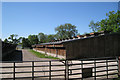
Intensive production of something
Another row of houses lies beyond this on the map. One house can be glimpsed, left. Their roofs are seen in Image
Image: © Robin Stott
Taken: 22 May 2010
0.17 miles
5
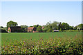
Buildings southeast of Fen End Farm
Seen over the thorn hedge by the dead-straight Oldwich Lane East. These are features characteristic of the Arden pastures landscape type south of Balsall Common. Here we are on the edge of it, with signs of the Ancient Arden landscape around Fen End to the west.
Image: © Robin Stott
Taken: 22 May 2010
0.18 miles
6
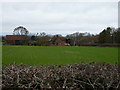
Fen End Farm
A 19th century farm development, set back from Oldwich Lane East.
Image: © Richard Law
Taken: 7 Jan 2019
0.19 miles
7
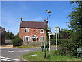
Fen End
The cottage at the crossroads near Fen End, along with some aged street furniture!
Image: © David Stowell
Taken: 21 Aug 2005
0.20 miles
8
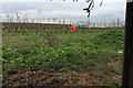
Landscaping of a vehicle proving ground, Honiley
Jaguar Land Rover (JLR) have gone to great lengths to prevent views into the redeveloped proving ground and of the track itself, although it can be clearly seen in satellite photos https://wtp2.appspot.com/wheresthepath.htm?lat=52.363816&lon=-1.661831&lz=14&rz=17<=OS&rt=satellite&lov=None&rov=None&lgrat=UK1000&rgrat=UK1000 This view is through a rare gap in the boundary hedge of a neighbouring meadow traversed by a public footpath. The test track is beyond the high bank, itself behind a high security fence, soon to be concealed by a planted tree screen. The lifebelt suggests a moat or a surface water lagoon. There is a metre-high mesh fence below the camera. The site was formerly a World War II airfield.
Image: © Robin Stott
Taken: 17 Apr 2017
0.20 miles
9
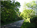
Honiley Road
Runs dead straight between Runway Farm and Fen End. Here it's alongside Hawkesmill Nurseries on the right.
Image: © Robin Stott
Taken: 22 May 2010
0.22 miles
10

Entrance to Prodrive.
This is the closely guarded entrance to the Prodrive proving ground which occupies the old Fen End airfield.
Image: © Nigel Mykura
Taken: 24 Apr 2011
0.23 miles