1
The junction of Whites Row and Warwick Road, Kenilworth
The red brick three storey houses are 190-192 Warwick Road. Between them and the white rendered building on the right is the original line of Whites Row. Although still open to cars, due to its narrowness most vehicles now use the link between Whites Row and St John's Street which I believe was built in the early 1970's.
Image: © John Brightley
Taken: 20 Apr 2004
0.01 miles
2
Looking north-west in Warwick Road
(standing just outside St John's Church)
Image: © Basher Eyre
Taken: 11 Feb 2019
0.01 miles
3
St John's Church in Kenilworth
Image: © Mat Fascione
Taken: 18 Apr 2015
0.02 miles
4
St John, Kenilworth: tree in the churchyard
Image: © Basher Eyre
Taken: 11 Feb 2019
0.02 miles
5
Church of St John, Kenilworth
Image: © AJD
Taken: Unknown
0.02 miles
6
Church of St John, Kenilworth
Image: © AJD
Taken: Unknown
0.02 miles
7
194-200 Warwick Road, Kenilworth
The photo is taken from the entrance to St John's Church car park, with the Jet petrol station just visible on the left.
The white cottage on the left is 200 Warwick Road and the small single storey building to the right of it used to be a smithy. The house to the right of that (198 Warwick Road), was a pub, the Malt Shovel, from before 1835 to its closure in 1923. It was sometimes known as 'The Mouse Trap'.
Warwick Road was known as Castle End until about 1890.
(Some of the information above is obtained from 'The Inns and Roads of Kenilworth' by Rob Steward (2000))
Image: © John Brightley
Taken: 20 Apr 2004
0.03 miles
8
St John's Parish Church, Kenilworth
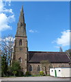
The Church of St John the Evangelist , on Warwick Road in Kenilworth, is an Anglican Parish Church dating from 1851-2. It is a Grade II* listed building (http://www.britishlistedbuildings.co.uk/en-307853-church-of-st-john-evangelist-kenilworth - British Listed Buildings).
The church has its own web site http://www.kenjohn.plus.com/
Image: © David Dixon
Taken: 7 Aug 2011
0.03 miles
9
St John's Church, Kenilworth
Image: © Ian S
Taken: 23 May 2013
0.03 miles
10
St John, Kenilworth: February 2019
Image: © Basher Eyre
Taken: 11 Feb 2019
0.03 miles


