The junction of Whites Row and Warwick Road, Kenilworth
Introduction
The photograph on this page of The junction of Whites Row and Warwick Road, Kenilworth by John Brightley as part of the Geograph project.
The Geograph project started in 2005 with the aim of publishing, organising and preserving representative images for every square kilometre of Great Britain, Ireland and the Isle of Man.

There are currently over 7.5m images from over 14,400 individuals and you can help contribute to the project by visiting https://www.geograph.org.uk
The junction of Whites Row and Warwick Road, Kenilworth
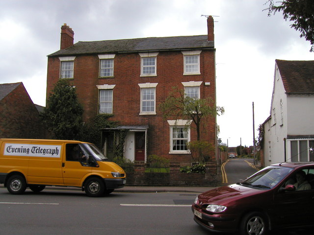
Image: © John Brightley Taken: 20 Apr 2004
The red brick three storey houses are 190-192 Warwick Road. Between them and the white rendered building on the right is the original line of Whites Row. Although still open to cars, due to its narrowness most vehicles now use the link between Whites Row and St John's Street which I believe was built in the early 1970's.
Images are licensed for reuse under creativecommons.org/licenses/by-sa/2.0
Image Location
Latitude
52.336764
Longitude
-1.573456