194-200 Warwick Road, Kenilworth
Introduction
The photograph on this page of 194-200 Warwick Road, Kenilworth by John Brightley as part of the Geograph project.
The Geograph project started in 2005 with the aim of publishing, organising and preserving representative images for every square kilometre of Great Britain, Ireland and the Isle of Man.

There are currently over 7.5m images from over 14,400 individuals and you can help contribute to the project by visiting https://www.geograph.org.uk
194-200 Warwick Road, Kenilworth
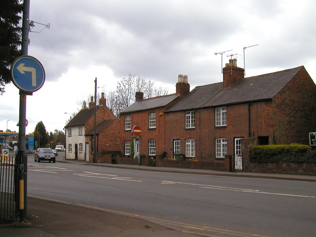
Image: © John Brightley Taken: 20 Apr 2004
The photo is taken from the entrance to St John's Church car park, with the Jet petrol station just visible on the left. The white cottage on the left is 200 Warwick Road and the small single storey building to the right of it used to be a smithy. The house to the right of that (198 Warwick Road), was a pub, the Malt Shovel, from before 1835 to its closure in 1923. It was sometimes known as 'The Mouse Trap'. Warwick Road was known as Castle End until about 1890. (Some of the information above is obtained from 'The Inns and Roads of Kenilworth' by Rob Steward (2000))
Images are licensed for reuse under creativecommons.org/licenses/by-sa/2.0
Image Location
Latitude
52.336493
Longitude
-1.573165