1
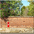
Berkeley Road, Kenilworth
The large trees between the houses on the right mark the site of one of two former stone quarries along this road (the second is by the bend in the distance),from which reputedly stone was obtained to build the Castle and the Abbey. They are overgrown, but still clearly visible holes in the ground. Forty years after the housing estate was built, these two pieces of land are still owned by the estate's developers', Bryant Homes.
Image: © John Brightley
Taken: 26 May 2010
0.08 miles
2
Fieldgate Lane
Thatched houses of indeterminate age in Fieldgate Lane.
Image: © E Gammie
Taken: 16 Apr 2012
0.10 miles
3
Footpath between Elmbank Road and Monmouth Close
Looking from the turn of the footpath out towards Elmbank Road, and showing old sandstone boundary wall - which continues at the other side of Elmbank Road. It seems to mark the northern boundaries of the gardens to the properties on High Street.
Image: © John Brightley
Taken: 26 May 2010
0.11 miles
4
Bole of a pedunculate oak, Fieldgate Lane, Kenilworth
For more information and a full view of this impressive veteran tree, see
Image
Image: © A J Paxton
Taken: 10 Oct 2023
0.12 miles
5
Veteran tree in Fieldgate Lane
According to the Woodland Trust ancient tree site, this tree has been recorded by the Warwickshire Biological Records Centre as a veteran pedunculate oak with a trunk girth of 6.40m (tree no. 80214).
Image: © E Gammie
Taken: 16 Apr 2012
0.12 miles
6
Veteran oak tree, Fieldgate Lane, Kenilworth
This massive tree stands in a front garden in Fieldgate Lane, but can be seen from the road. It appears to be the veteran tree recorded in this vicinity in the ancient tree inventory of the Woodland Trust, as a pedunculate oak, Quercus robur, with a girth of 6.4m at a height of 1.5m https://ati.woodlandtrust.org.uk/tree-search/tree?treeid=80214&from=3523&v=2422369&ml=map&z=17&nwLat=52.35465710336496&nwLng=-1.584782015103099&seLat=52.35117739113758&seLng=-1.5803402769744368#/ . For a close up of the bole or trunk, see
Image For a photo of this tree leafless from 2012 see
Image
Image: © A J Paxton
Taken: 10 Oct 2023
0.13 miles
7
Residential complex, north side of High Street, Kenilworth
The barn on the left bears a modern nameplate 'The Stone House'. Awaiting further information.
Update 21 May 2015
John Brightley comments: "This is still just one house with outbuildings - probably the most impressive house in Kenilworth. For sale at the moment - the most expensive house in Kenilworth on Rightmove. There's a good chance that when it is sold, the outbuildings will be turned into separate dwellings."
Image: © Robin Stott
Taken: 19 Apr 2014
0.13 miles
8
Kenilworth houses [26]
Formerly the coach house to number 64, this would appear to have been converted into a dwelling. There is a fine Palladian window with dovecote and weather vane above. Listed, grade II, with details at: https://historicengland.org.uk/listing/the-list/list-entry/1300411
Kenilworth is a market town some 6 miles south west of Coventry. The town lies on Finham Brook, a tributary of the River Sowe, which joins the River Avon about 2 miles to the north-east. A priory and a castle were built at the same time around 1122. A field in the town is named Parliament Field as Henry III held a Parliament there in August 1266 whilst his troops were besieging the castle. Kenilworth today is a dormitory town for commuters to Coventry, Birmingham and Leamington Spa.
Image: © Michael Dibb
Taken: 6 Aug 2020
0.13 miles
9
Doves and dovecot, High Street, Kenilworth
This courtyard of buildings is adjacent to the Stone House, 64 High Street.
Image: © John Brightley
Taken: 23 Oct 2011
0.13 miles
10
Garden wall, High Street, Kenilworth
It supports wall-mounted postbox CV8 393. Note the base of the wall, made of something like the greyish-cream Warwick sandstone rather than the red-brown Kenilworth or Coventry sandstone.
Image: © Robin Stott
Taken: 19 Apr 2014
0.14 miles


![Kenilworth houses [26]](https://s1.geograph.org.uk/geophotos/06/63/65/6636593_6055c881_120x120.jpg)

