IMAGES TAKEN NEAR TO
Wall Hill Road, COVENTRY, CV7 8AF
Introduction
This page details the photographs taken nearby to Wall Hill Road, CV7 8AF by members of the Geograph project.
The Geograph project started in 2005 with the aim of publishing, organising and preserving representative images for every square kilometre of Great Britain, Ireland and the Isle of Man.

There are currently over 7.5m images from over14,400 individuals and you can help contribute to the project by visiting https://www.geograph.org.uk
Image Map
Images are licensed for reuse under creativecommons.org/licenses/by-sa/2.0
Notes
- Clicking on the map will re-center to the selected point.
- The higher the marker number, the further away the image location is from the centre of the postcode.
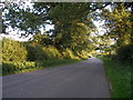
Image Listing (2 Images Found)
Images are licensed for reuse under creativecommons.org/licenses/by-sa/2.0
Image
Details
Distance
2
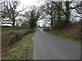
The Lane at Wall Hill, near Corley
This stretch of lane cuts through the corner of this square. Behind the photographer is a cottage and a line of pylons, and just beyond the car in the photograph the road forks to Brownshill Green and Hawkes End.
Image: © John Evans
Taken: 3 Sep 2006
0.08 miles