IMAGES TAKEN NEAR TO
Berkswell Road, COVENTRY, CV6 7DJ
Introduction
This page details the photographs taken nearby to Berkswell Road, CV6 7DJ by members of the Geograph project.
The Geograph project started in 2005 with the aim of publishing, organising and preserving representative images for every square kilometre of Great Britain, Ireland and the Isle of Man.

There are currently over 7.5m images from over14,400 individuals and you can help contribute to the project by visiting https://www.geograph.org.uk
Image Map
Images are licensed for reuse under creativecommons.org/licenses/by-sa/2.0
Notes
- Clicking on the map will re-center to the selected point.
- The higher the marker number, the further away the image location is from the centre of the postcode.
Image Listing (23 Images Found)
Images are licensed for reuse under creativecommons.org/licenses/by-sa/2.0
Image
Details
Distance
1

Hall Green cottages, Windmill Road, Foleshill
Foleshill was a large parish of scattered settlements, with houses built around greens or spread out along roads. Coal mining, ribbon weaving and agriculture dominated the local economy. The parish fields were enclosed in 1775 and Windmill Lane, today Windmill Road, was laid out at this time. These cottages, part of a settlement historically known as Hall Green, would have been built alongside the road some time later. The change of name to Windmill Road reflects the spread of Coventry suburbs into the area at the end of the 19th and early 20th centuries. See David Fry & Albert Smith, The Coventry we have lost: Forgotten Foleshill, Simanda Press, 2018.
Image: © A J Paxton
Taken: 22 Mar 2023
0.15 miles
2

Footpath alongside the mill race, Hall Green
A mill race is a channel constructed to conduct water away from a stream or river to power the wheel of a watermill and then onwards to rejoin the main stream again. This path runs alongside the course of the mill race downstream from Foleshill Mill, along which the water flowed from the mill back into the River Sowe. Mill and mill race can be seen on the OS six inch map (1888-1913 series). There is no sign of them now. Just beyond the cast iron posts the path bridges the modern course of the Sowe, immediately downstream from where it was joined by the mill race. It then follows the course of the mill race to Mill House, an 18th century house Image
Image: © A J Paxton
Taken: 22 Mar 2023
0.17 miles
3

A stone insert
The stone insert gives a date of 1882 when I presume this brick extension to the church was built.
Image: © Malcolm Neal
Taken: 17 Sep 2018
0.18 miles
4
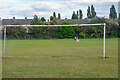
Coventry : Cubbington Road Open Space
An open space for people to enjoy.
Image: © Lewis Clarke
Taken: 25 Sep 2021
0.18 miles
5
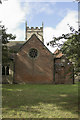
St. Laurence's Church
A view of the rear of St. Laurence's church with some brick built extensions. They do rather ruin the look of the church.
Image: © Malcolm Neal
Taken: 17 Sep 2018
0.18 miles
6

The Saxon font
By far the oldest artifact in the church of St. Laurence is this font. It is dated to Saxon times according to information on douments inside the church.
Image: © Malcolm Neal
Taken: 17 Sep 2018
0.18 miles
7
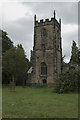
St. Laurence Parish Church
The parish church of Foleshill is St. Laurence. It is set in quite a grave yard from which many of the grave stones have disappeared.
Image: © Malcolm Neal
Taken: 17 Sep 2018
0.19 miles
8
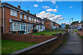
Coventry : Cubbington Road
Looking along a path to Cubbington Road.
Image: © Lewis Clarke
Taken: 25 Sep 2021
0.19 miles
9
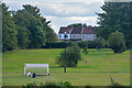
Coventry : Cubbington Road Open Space
An open space for people to enjoy.
Image: © Lewis Clarke
Taken: 25 Sep 2021
0.19 miles