Hall Green cottages, Windmill Road, Foleshill
Introduction
The photograph on this page of Hall Green cottages, Windmill Road, Foleshill by A J Paxton as part of the Geograph project.
The Geograph project started in 2005 with the aim of publishing, organising and preserving representative images for every square kilometre of Great Britain, Ireland and the Isle of Man.

There are currently over 7.5m images from over 14,400 individuals and you can help contribute to the project by visiting https://www.geograph.org.uk
Hall Green cottages, Windmill Road, Foleshill
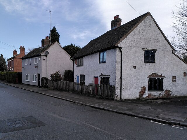
Image: © A J Paxton Taken: 22 Mar 2023
Foleshill was a large parish of scattered settlements, with houses built around greens or spread out along roads. Coal mining, ribbon weaving and agriculture dominated the local economy. The parish fields were enclosed in 1775 and Windmill Lane, today Windmill Road, was laid out at this time. These cottages, part of a settlement historically known as Hall Green, would have been built alongside the road some time later. The change of name to Windmill Road reflects the spread of Coventry suburbs into the area at the end of the 19th and early 20th centuries. See David Fry & Albert Smith, The Coventry we have lost: Forgotten Foleshill, Simanda Press, 2018.
Images are licensed for reuse under creativecommons.org/licenses/by-sa/2.0
Image Location
Latitude
52.442903
Longitude
-1.475481