Footpath alongside the mill race, Hall Green
Introduction
The photograph on this page of Footpath alongside the mill race, Hall Green by A J Paxton as part of the Geograph project.
The Geograph project started in 2005 with the aim of publishing, organising and preserving representative images for every square kilometre of Great Britain, Ireland and the Isle of Man.

There are currently over 7.5m images from over 14,400 individuals and you can help contribute to the project by visiting https://www.geograph.org.uk
Footpath alongside the mill race, Hall Green
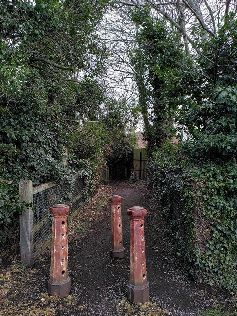
Image: © A J Paxton Taken: 22 Mar 2023
A mill race is a channel constructed to conduct water away from a stream or river to power the wheel of a watermill and then onwards to rejoin the main stream again. This path runs alongside the course of the mill race downstream from Foleshill Mill, along which the water flowed from the mill back into the River Sowe. Mill and mill race can be seen on the OS six inch map (1888-1913 series). There is no sign of them now. Just beyond the cast iron posts the path bridges the modern course of the Sowe, immediately downstream from where it was joined by the mill race. It then follows the course of the mill race to Mill House, an 18th century house Image
Images are licensed for reuse under creativecommons.org/licenses/by-sa/2.0
Image Location
Latitude
52.443352
Longitude
-1.475181