
IMAGES TAKEN NEAR TO
Wilsons Lane, COVENTRY, CV6 6NY
Introduction
This page details the photographs taken nearby to Wilsons Lane, CV6 6NY by members of the Geograph project.
The Geograph project started in 2005 with the aim of publishing, organising and preserving representative images for every square kilometre of Great Britain, Ireland and the Isle of Man.

There are currently over 7.5m images from over14,400 individuals and you can help contribute to the project by visiting https://www.geograph.org.uk
Image Map
Images are licensed for reuse under creativecommons.org/licenses/by-sa/2.0
Notes
- Clicking on the map will re-center to the selected point.
- The higher the marker number, the further away the image location is from the centre of the postcode.
Image Listing (50 Images Found)
Images are licensed for reuse under creativecommons.org/licenses/by-sa/2.0
Image
Details
Distance
1
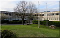
Wayside Business Park, Coventry
Viewed from Wilson's Lane, near M6 motorway junction 3.
Image: © Jaggery
Taken: 19 Apr 2015
0.04 miles
2
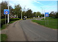
Weight limit ahead, Wilson's Lane, Coventry
Signs show a 7.5 tonnes vehicle weight limit ½ mile ahead.
The entrance to Novotel Coventry http://www.geograph.org.uk/photo/4437880 is a few tens of metres behind the parked car.
Image: © Jaggery
Taken: 19 Apr 2015
0.07 miles
3
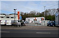
Listers Volkswagen Van Centre, Longford, Coventry
On the west side of Bedworth Road.
Image: © Jaggery
Taken: 19 Apr 2015
0.08 miles
4
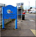
Welcome to Longford Village, Coventry
The sign is on the corner of Bedworth Road and Ibstock Road in the north of Coventry.
Image: © Jaggery
Taken: 19 Apr 2015
0.10 miles
5
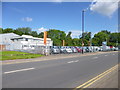
Longford, Listers Van Centre
Much of the commercial activity on Bedworth Road seems vehicle-related.
Image: © Mike Faherty
Taken: 8 Jun 2014
0.10 miles
6
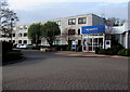
Novotel, Coventry
Hotel in Wilson's Lane, near M6 motorway junction 3.
Image: © Jaggery
Taken: 19 Apr 2015
0.10 miles
7
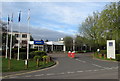
Entrance to Novotel, Coventry
Hotel entrance from Wilson's Lane, near M6 motorway junction 3.
Image: © Jaggery
Taken: 19 Apr 2015
0.10 miles
8
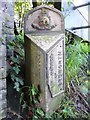
Old Boundary Marker by the B4113, Bedworth Road, Coventry
Parish Boundary Marker by the B4113, in parish of Coventry (Coventry District), Bedworth Road, against northern end of railway bridge.
Surveyed
Milestone Society National ID: WA_COVBD2pb.
Image: © Milestone Society
Taken: Unknown
0.10 miles
9
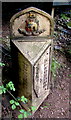
Coventry/Bedworth boundary marker
On the west side of the B4113 at the edge of this http://www.geograph.org.uk/photo/4439051 bridge.
CITY OF COVENTRY on the left side. URBAN DISTRICT OF BEDWORTH on the right side.
Image: © Jaggery
Taken: 19 Apr 2015
0.11 miles
10
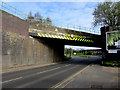
South side of a railway bridge at the northern edge of Coventry
The bridge carries the Coventry to Nuneaton Line over the B4113. Headroom shown is 4.8 metres (15' 9").
An M6 motorway flyover is in the background.
Image: © Jaggery
Taken: 19 Apr 2015
0.11 miles