Old Boundary Marker by the B4113, Bedworth Road, Coventry
Introduction
The photograph on this page of Old Boundary Marker by the B4113, Bedworth Road, Coventry by Milestone Society as part of the Geograph project.
The Geograph project started in 2005 with the aim of publishing, organising and preserving representative images for every square kilometre of Great Britain, Ireland and the Isle of Man.

There are currently over 7.5m images from over 14,400 individuals and you can help contribute to the project by visiting https://www.geograph.org.uk
Old Boundary Marker by the B4113, Bedworth Road, Coventry
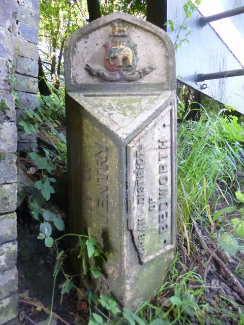
Image: © Milestone Society Taken: Unknown
Parish Boundary Marker by the B4113, in parish of Coventry (Coventry District), Bedworth Road, against northern end of railway bridge. Surveyed Milestone Society National ID: WA_COVBD2pb.
Images are licensed for reuse under creativecommons.org/licenses/by-sa/2.0
Image Location
Latitude
52.457148
Longitude
-1.484583