
IMAGES TAKEN NEAR TO
Lancaster Gardens, COVENTRY, CV6 6HF
Introduction
This page details the photographs taken nearby to Lancaster Gardens, CV6 6HF by members of the Geograph project.
The Geograph project started in 2005 with the aim of publishing, organising and preserving representative images for every square kilometre of Great Britain, Ireland and the Isle of Man.

There are currently over 7.5m images from over14,400 individuals and you can help contribute to the project by visiting https://www.geograph.org.uk
Image Map
Images are licensed for reuse under creativecommons.org/licenses/by-sa/2.0
Notes
- Clicking on the map will re-center to the selected point.
- The higher the marker number, the further away the image location is from the centre of the postcode.
Image Listing (31 Images Found)
Images are licensed for reuse under creativecommons.org/licenses/by-sa/2.0
Image
Details
Distance
2
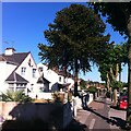
Monkey puzzle tree, Lythalls Lane, Holbrooks
A monkey puzzle tree stands in a front garden on Lythalls Lane, a striking foil to the street trees, an avenue of severely pruned London planes. The monkey puzzle tree that is normally grown in Europe is the hardiest species in its genus, Araucaria araucana, which is native to Chile and Argentina, where it grows on the lower slopes of the Andes mountain range; see Wikipedia https://en.wikipedia.org/wiki/Araucaria_araucana .
Image: © A J Paxton
Taken: 11 Aug 2022
0.08 miles
3
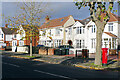
Lythalls Lane, Holbrooks
Quite a variety of house styles here on the north side of Lythalls Lane.
Image: © Stephen McKay
Taken: 18 Nov 2022
0.09 miles
4
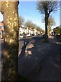
London plane trees, Lythalls Lane, Holbrooks, Coventry
These severely pruned trees are a distinctive feature of this part of the city.
Image: © A J Paxton
Taken: 5 May 2014
0.09 miles
5
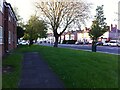
Holbrook Lane, looking towards junction with Lythalls Lane and Rotherham Road
The buildings on the left, supported housing units, have since been demolished.
Image: © A J Paxton
Taken: 6 May 2018
0.10 miles
6
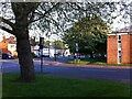
Holbrook Lane, looking southwards from junction with Everdon Road
The supporting housing building on the right has since been demolished.
Image: © A J Paxton
Taken: 6 May 2018
0.11 miles
7
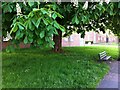
Horse chestnut tree in bloom on Holbrook Lane
The horse chestnut tree stands on a verge near the junction with Everdon Road. Behind it stand two blocks of supported housing which have since been demolished.
Image: © A J Paxton
Taken: 6 May 2018
0.12 miles
8
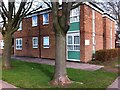
Supported housing block, Everdon Road, Coventry
One of two blocks at the junction of Everdon Road and Holbrook Lane. This one stood on the north side of Everdon Road, while another, of very similar design, stood to the south. Each fronted onto a communal yard shared with bungalows. This photo was taken at the entry to the yard from Everdon Road, and the entrance to the block can be seen just to the right of the left-hand tree trunk. The block comprised 15 bedsits, each with a small kitchen and a toilet, with shared shower rooms, lounge and utility room and a site office. They were built as social housing for elderly people. More recently, both blocks were let to property guardians, before being demolished in 2020. Bungalows are now being built on the site.
Image: © A J Paxton
Taken: 17 Mar 2018
0.12 miles
9
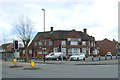
The Holly Bush public house, Coventry
On Holbrook Lane.
Image: © JThomas
Taken: 4 Mar 2017
0.12 miles
10
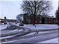
Junction of Everdon Road and Holbrook Lane
The two-storey sheltered housing in the right hand middle distance was demolished in 2020, as was its counterpart on the other side of Everdon Road (off to the left and not visible in this photo). Housing is being built on the site.
Image: © A J Paxton
Taken: 18 Mar 2018
0.12 miles