Supported housing block, Everdon Road, Coventry
Introduction
The photograph on this page of Supported housing block, Everdon Road, Coventry by A J Paxton as part of the Geograph project.
The Geograph project started in 2005 with the aim of publishing, organising and preserving representative images for every square kilometre of Great Britain, Ireland and the Isle of Man.

There are currently over 7.5m images from over 14,400 individuals and you can help contribute to the project by visiting https://www.geograph.org.uk
Supported housing block, Everdon Road, Coventry
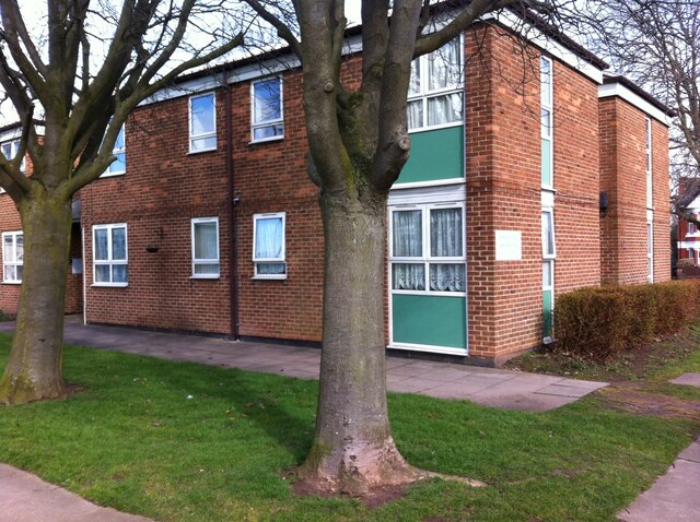
Image: © A J Paxton Taken: 17 Mar 2018
One of two blocks at the junction of Everdon Road and Holbrook Lane. This one stood on the north side of Everdon Road, while another, of very similar design, stood to the south. Each fronted onto a communal yard shared with bungalows. This photo was taken at the entry to the yard from Everdon Road, and the entrance to the block can be seen just to the right of the left-hand tree trunk. The block comprised 15 bedsits, each with a small kitchen and a toilet, with shared shower rooms, lounge and utility room and a site office. They were built as social housing for elderly people. More recently, both blocks were let to property guardians, before being demolished in 2020. Bungalows are now being built on the site.
Images are licensed for reuse under creativecommons.org/licenses/by-sa/2.0
Image Location
Latitude
52.4408
Longitude
-1.509195