IMAGES TAKEN NEAR TO
Jimmy Hill Way, COVENTRY, CV6 5RT
Introduction
This page details the photographs taken nearby to Jimmy Hill Way, CV6 5RT by members of the Geograph project.
The Geograph project started in 2005 with the aim of publishing, organising and preserving representative images for every square kilometre of Great Britain, Ireland and the Isle of Man.

There are currently over 7.5m images from over14,400 individuals and you can help contribute to the project by visiting https://www.geograph.org.uk
Image Map
Images are licensed for reuse under creativecommons.org/licenses/by-sa/2.0
Notes
- Clicking on the map will re-center to the selected point.
- The higher the marker number, the further away the image location is from the centre of the postcode.
Image Listing (13 Images Found)
Images are licensed for reuse under creativecommons.org/licenses/by-sa/2.0
Image
Details
Distance
1
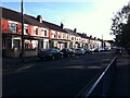
Beresford Avenue, Foleshill
Beresford Avenue is one of a group of early 20th century streets in suburban Coventry with names redolent of the British empire and naval power at their peak in the late 19th and early 20th centuries: Fisher, Churchill and Durbar are others. Beresford presumably refers to Admiral Charles William de la Poer Beresford, hero of campaigns in Egypt and Sudan and later an MP and Commander in Chief of the Channel Fleet and later the Mediterrannean Fleet; a summary of his life can be found at the Beresford family site http://www.beresfordfamilysociety.org/background.html . This is now one of the most multicultural districts of Coventry, with families of mainly south Asian heritage: "We are here because you were there".
Image: © A J Paxton
Taken: 14 Jul 2022
0.10 miles
2
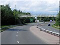
A444, Footbridge near Holbrook Primary School
Image: © David Dixon
Taken: 5 Aug 2013
0.10 miles
3
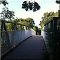
Footbridge from Foleshill to Holbrooks
This metal footbridge crosses the A444 Jimmy Hill Way, formerly known as Phoenix Way, which is the main road northwards out of Coventry and was constructed in the 1990s. The footbridge connects Beresford Road in Foleshill with Holbrook Primary School and with Lythalls Lane via Copper Beech Close.
Image: © A J Paxton
Taken: 14 Jul 2022
0.11 miles
4
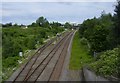
Coventry-Holbrook Way
Looking down on to the Coventry-Nuneaton Railway.The spur off to the left ran to the former Keresley Colliery, and now goes to the Prologis Park Terminal. But it has not been used for several years. The Ricoh Arena and the Lythalls Lane bridge can be seen in the distance.
Image: © Ian Rob
Taken: 4 Jun 2011
0.17 miles
5
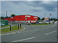
Coventry-Newport Road
Business Unit at the junction with College Road.
Image: © Ian Rob
Taken: 4 Jun 2011
0.17 miles
6
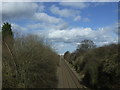
Railway towards Nuneaton
Looking north east.
Image: © JThomas
Taken: 4 Mar 2017
0.18 miles
7
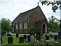
Coventry-Saint Paul's Cemetery
Dilapidated chapel in the cemetery off Holbrook Lane.
Image: © Ian Rob
Taken: 4 Jun 2011
0.19 miles
8
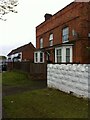
Former farm buildings, Lythalls Lane, Coventry
Buildings of a farm, marked on the OS 6-inch map of 1888-1913 as Hollybank Farm, now deep in the built-up area of Coventry. https://maps.nls.uk/geo/explore/side-by-side/#zoom=16&lat=52.43930&lon=-1.49834&layers=6&right=OSAPI The farmhouse is still used as housing while the building beyond it is part of a motor business.
Image: © A J Paxton
Taken: 21 May 2021
0.21 miles