
IMAGES TAKEN NEAR TO
Peel Street, COVENTRY, CV6 5DZ
Introduction
This page details the photographs taken nearby to Peel Street, CV6 5DZ by members of the Geograph project.
The Geograph project started in 2005 with the aim of publishing, organising and preserving representative images for every square kilometre of Great Britain, Ireland and the Isle of Man.

There are currently over 7.5m images from over14,400 individuals and you can help contribute to the project by visiting https://www.geograph.org.uk
Image Map
Images are licensed for reuse under creativecommons.org/licenses/by-sa/2.0
Notes
- Clicking on the map will re-center to the selected point.
- The higher the marker number, the further away the image location is from the centre of the postcode.
Image Listing (70 Images Found)
Images are licensed for reuse under creativecommons.org/licenses/by-sa/2.0
Image
Details
Distance
1
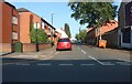
Peel Street, Coventry
From Stoney Stanton Road
Image: © David Howard
Taken: 21 May 2023
0.02 miles
2
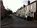
Peel Street, Foleshill, Coventry
We are looking west along Peel Street towards Stoney Stanton Road, where a white shikhara or domed tower of the Hindu temple can be seen.
This street was laid out in the 1850s as part of a development by the Coventry and Warwickshire Artizans Freehold Land Society. For more on this society see Image A sense of its members' political views can be gained from the street names; Peel refers to Sir Robert Peel, the Tory politician who served as prime minister from 1834–1835 and 1841–1846 and who played a central role in the formation of the modern Conservative Party.
The development proceeded slowly, and the houses in this photo have a late 19th or early 20th century appearance; see the discussion in Fry, D & Smith, A, The Coventry we have lost: Forgotten Foleshill, Simanda Press, Berkswell, pp91-92.
Many of the houses in this district now belong to housing associations, and in the 2010s they were given an external insulating cladding to improve their energy efficiency. This can be seen on some of the houses on the right hand side, particularly around the door visible at the right edge of the photo.
Image: © A J Paxton
Taken: 26 Aug 2021
0.04 miles
4
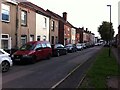
Cobden Street, Foleshill, Coventry
This view shows Cobden Street looking south towards Red Lane; the block of flats in the distance is in Hillfields.
Cobden Street was laid out in the 1850s as part of a development by the Coventry and Warwickshire Artizans Freehold Land Society. For more on this society see Image
David Fry & Albert Smith suggest that a sense of the Society's members' political views can be gained from the street names they chose. Cobden refers to Richard Cobden, the radical and Liberal politician who formed the Anti-Corn Law League along with John Bright; the land society also laid out a Bright Street nearby. The League was a free trade movement that campaigned to end the protectionist corn laws, which taxed imported wheat to the benefit of landowners but at the cost of increased bread prices. Cobden & Bright succeeded in abolishing the corn laws in 1846, with belated support from the Tory prime minister Sir Robert Peel, after whom another of the streets is named. Cobden was later responsible for the 1860 Cobden-Chevalier free trade treaty with France, which led to the collapse of the Coventry ribbon weaving industry and the ruin of many local people, but the street name endured. https://en.wikipedia.org/wiki/Richard_Cobden
The development of the estate proceeded slowly, and many of the houses in this photo may date from later in the 19th century or even early 20th century, though the addition of insulating cladding in the 2010s has obscured many of the architectural clues; see the discussion in Fry, D & Smith, A, The Coventry we have lost: Forgotten Foleshill, Simanda Press, Berkswell, pp91-92. The area also suffered heavily from bombing in the second world war.
Image: © A J Paxton
Taken: 26 Aug 2021
0.05 miles
5
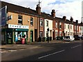
Stoney Stanton Road, Coventry, viewed from the entrance to Webster's Park
This row of houses on Stoney Stanton Road is part of the development laid out in the 1850s by the Coventry & Warwickshire Artizans Freehold Land Society, which was established in 1851. Freehold Land Societies aimed to make home ownership available to working men, who as householders would then also have the right to vote. Freehold Street in Hillfields was another Coventry example - see here Image
A member of the Coventry & Warwickshire Artizans Freehold Land Society could be allocated one of 262 plots on which to build a house. The member would then pay the society back over a number of years. This project does not appear to have been as successful as some other such societies in Coventry, and some plots were bought up in blocks by developers and built on. The area later suffered heavy bomb damage in the second world war. See Fry, D & Smith, A, The Coventry we have lost: Forgotten Foleshill, Simanda Press, Berkswell, pp91-92.
Image: © A J Paxton
Taken: 26 Aug 2021
0.07 miles
6
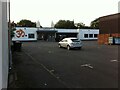
Hindu Temple, Stoney Stanton Road, Foleshill
This is a mandir or temple of the Hindu Temple Society Coventry. A brief but informative history of the temple can be found on its website here https://hindutemplesociety.co.uk/home/brief-history/ . The temple is set well back from the road, behind a car park and behind and alongside the neighbouring Gulf petrol station. The temple's distinctive pair of shikharas, the domed towers, make it visible from the street, however, as does the large orange symbol on the front elevation, which represents the sacred syllable Om that is intoned in prayer and worship.
The temple, at 380 Stoney Stanton Road, opened in 2011 and replaced an earlier temple at no. 274, which has since been demolished; it can be seen on this geograph Image
Image: © A J Paxton
Taken: 26 Aug 2021
0.08 miles
7
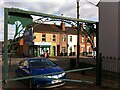
Stoney Stanton Road, seen from the entrance to Webster's Park
This is the view from the gate to Webster's Park, looking out to Stoney Stanton Road at the junction with Bright Street.
Image: © A J Paxton
Taken: 26 Aug 2021
0.08 miles
8
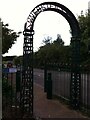
Entrance to Webster's Park, Foleshill, Coventry
This is the pedestrian entrance from Stoney Stanton Road to Webster's Park, which has been laid out on part of the former Webster's brickworks site.
Image: © A J Paxton
Taken: 26 Aug 2021
0.10 miles
10
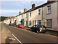
Terraced houses, Red Lane, Coventry
Built in the late 19th century with single-skin external walls of red brick, these houses have in most cases been given a layer of external cladding for insulation, as part of a programme of energy conservation work undertaken by housing associations around 2013-15.
Image: © A J Paxton
Taken: 14 Jun 2021
0.11 miles