Stoney Stanton Road, Coventry, viewed from the entrance to Webster's Park
Introduction
The photograph on this page of Stoney Stanton Road, Coventry, viewed from the entrance to Webster's Park by A J Paxton as part of the Geograph project.
The Geograph project started in 2005 with the aim of publishing, organising and preserving representative images for every square kilometre of Great Britain, Ireland and the Isle of Man.

There are currently over 7.5m images from over 14,400 individuals and you can help contribute to the project by visiting https://www.geograph.org.uk
Stoney Stanton Road, Coventry, viewed from the entrance to Webster's Park
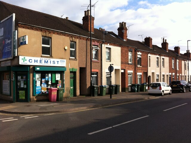
Image: © A J Paxton Taken: 26 Aug 2021
This row of houses on Stoney Stanton Road is part of the development laid out in the 1850s by the Coventry & Warwickshire Artizans Freehold Land Society, which was established in 1851. Freehold Land Societies aimed to make home ownership available to working men, who as householders would then also have the right to vote. Freehold Street in Hillfields was another Coventry example - see here Image A member of the Coventry & Warwickshire Artizans Freehold Land Society could be allocated one of 262 plots on which to build a house. The member would then pay the society back over a number of years. This project does not appear to have been as successful as some other such societies in Coventry, and some plots were bought up in blocks by developers and built on. The area later suffered heavy bomb damage in the second world war. See Fry, D & Smith, A, The Coventry we have lost: Forgotten Foleshill, Simanda Press, Berkswell, pp91-92.
Images are licensed for reuse under creativecommons.org/licenses/by-sa/2.0
Image Location
Latitude
52.422941
Longitude
-1.495276