
IMAGES TAKEN NEAR TO
Lilley Close, COVENTRY, CV6 4DW
Introduction
This page details the photographs taken nearby to Lilley Close, CV6 4DW by members of the Geograph project.
The Geograph project started in 2005 with the aim of publishing, organising and preserving representative images for every square kilometre of Great Britain, Ireland and the Isle of Man.

There are currently over 7.5m images from over14,400 individuals and you can help contribute to the project by visiting https://www.geograph.org.uk
Image Map
Images are licensed for reuse under creativecommons.org/licenses/by-sa/2.0
Notes
- Clicking on the map will re-center to the selected point.
- The higher the marker number, the further away the image location is from the centre of the postcode.
Image Listing (28 Images Found)
Images are licensed for reuse under creativecommons.org/licenses/by-sa/2.0
Image
Details
Distance
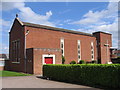
2
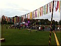
Party in the Park, Holbrook Park, Coventry
This family event is part of the UK City of Culture 2021 activities in Coventry.
Image: © A J Paxton
Taken: 14 Aug 2021
0.10 miles
3
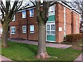
Supported housing block, Everdon Road, Coventry
One of two blocks at the junction of Everdon Road and Holbrook Lane. This one stood on the north side of Everdon Road, while another, of very similar design, stood to the south. Each fronted onto a communal yard shared with bungalows. This photo was taken at the entry to the yard from Everdon Road, and the entrance to the block can be seen just to the right of the left-hand tree trunk. The block comprised 15 bedsits, each with a small kitchen and a toilet, with shared shower rooms, lounge and utility room and a site office. They were built as social housing for elderly people. More recently, both blocks were let to property guardians, before being demolished in 2020. Bungalows are now being built on the site.
Image: © A J Paxton
Taken: 17 Mar 2018
0.12 miles
4
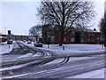
Junction of Everdon Road and Holbrook Lane
The two-storey sheltered housing in the right hand middle distance was demolished in 2020, as was its counterpart on the other side of Everdon Road (off to the left and not visible in this photo). Housing is being built on the site.
Image: © A J Paxton
Taken: 18 Mar 2018
0.12 miles
5
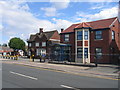
Holbrook Lane
The pub and the Gables Medical centre on the corner of Holbrooks Lane and Lythalls Lane in this northern suburb of Coventry.
Image: © David Stowell
Taken: 27 Aug 2006
0.13 miles
6
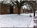
Pair of sheltered housing blocks on Everdon Road
The blocks stood to each side of the entrance of Everdon Road (where the pickup truck is parked) from Holbrook Lane, and are seen here from Holbrook Lane to the south. The black wooden bay facing onto Holbrook Lane housed the communal rubbish bins of each block; the front entrances were on the other side of the buildings. The blocks were demolished in 2020 and bungalows built on the site.
Image: © A J Paxton
Taken: 18 Mar 2018
0.13 miles
7
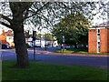
Holbrook Lane, looking southwards from junction with Everdon Road
The supporting housing building on the right has since been demolished.
Image: © A J Paxton
Taken: 6 May 2018
0.14 miles
8
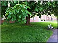
Horse chestnut tree in bloom on Holbrook Lane
The horse chestnut tree stands on a verge near the junction with Everdon Road. Behind it stand two blocks of supported housing which have since been demolished.
Image: © A J Paxton
Taken: 6 May 2018
0.14 miles
9
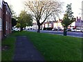
Holbrook Lane, looking towards junction with Lythalls Lane and Rotherham Road
The buildings on the left, supported housing units, have since been demolished.
Image: © A J Paxton
Taken: 6 May 2018
0.15 miles
10
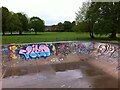
Skateboard park with graffiti, Holbrook Park
The skateboard park has two linked concrete basins, forming a figure-of-eight shape.
Image: © A J Paxton
Taken: 21 May 2021
0.15 miles