
IMAGES TAKEN NEAR TO
Sandhurst Grove, COVENTRY, CV6 3BN
Introduction
This page details the photographs taken nearby to Sandhurst Grove, CV6 3BN by members of the Geograph project.
The Geograph project started in 2005 with the aim of publishing, organising and preserving representative images for every square kilometre of Great Britain, Ireland and the Isle of Man.

There are currently over 7.5m images from over14,400 individuals and you can help contribute to the project by visiting https://www.geograph.org.uk
Image Map
Images are licensed for reuse under creativecommons.org/licenses/by-sa/2.0
Notes
- Clicking on the map will re-center to the selected point.
- The higher the marker number, the further away the image location is from the centre of the postcode.
Image Listing (55 Images Found)
Images are licensed for reuse under creativecommons.org/licenses/by-sa/2.0
Image
Details
Distance
1
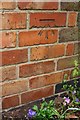
Benchmark on #1 Sandhurst Grove
Ordnance Survey cut mark benchmark levelled at 101.309m above Newlyn Datum
Image: © Roger Templeman
Taken: 30 Apr 2018
0.03 miles
2
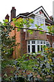
#1 Sandhurst Grove
There is an OS benchmark Image on the near corner, left hand face, of the house
Image: © Roger Templeman
Taken: 30 Apr 2018
0.03 miles
3
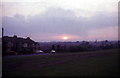
Radford Common
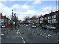
Land on the common is at 100m above sea level and drops away westward. To the left is Sandhurst Grove with short-terraced 1930's bay windowed houses typical of several of Coventry's suburbs.
Image: © FCG
Taken: Unknown
0.04 miles
4
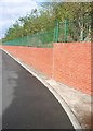
Embankment between Bridgeman Road and Radford Road
Between July 2005 and December 2005 the embankment between these two roads was stabilised and the retaining wall built. The trees and shrubs were planted as part of the works. Radford road was closed to vehicles for this period. The works cost £2.2m and were funded from central government. A streetlamp on Radford Road (which is higher than Bridgeman Road) can be seen against the sky. Bridgeman Road is the area of tarmac in the photo.
Image: © starkderrick
Taken: 7 Oct 2011
0.06 miles
7
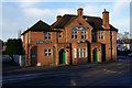
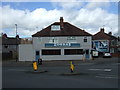
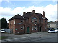
The Grapes public house, Radford Road, Coventry
Image: © Ian S
Taken: 25 Dec 2013
0.08 miles
9
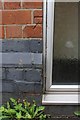
Part of benchmark on #1 Ellys Road
Ordnance Survey cut mark benchmark described on the Bench Mark Database at http://www.bench-marks.org.uk/bm92981
Image: © Roger Templeman
Taken: 30 Apr 2018
0.12 miles
10
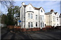
Houses at junction of Ellys Road and St Nicholas Street
There is a footpath over the railway leading from the end of the road at the left hand side of the image. There is an OS benchmark Image on the right hand side of the near house (#1 Ellys Road), near its front corner
Image: © Roger Templeman
Taken: 12 Feb 2018
0.12 miles