
IMAGES TAKEN NEAR TO
Norman Place Road, COVENTRY, CV6 2BT
Introduction
This page details the photographs taken nearby to Norman Place Road, CV6 2BT by members of the Geograph project.
The Geograph project started in 2005 with the aim of publishing, organising and preserving representative images for every square kilometre of Great Britain, Ireland and the Isle of Man.

There are currently over 7.5m images from over14,400 individuals and you can help contribute to the project by visiting https://www.geograph.org.uk
Image Map
Images are licensed for reuse under creativecommons.org/licenses/by-sa/2.0
Notes
- Clicking on the map will re-center to the selected point.
- The higher the marker number, the further away the image location is from the centre of the postcode.
Image Listing (11 Images Found)
Images are licensed for reuse under creativecommons.org/licenses/by-sa/2.0
Image
Details
Distance
1
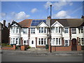
Houses on Norman Place Road, Coundon
For me, these houses are quintessentially suburban Coventry: semi detached or (as in this case) in short terraces, with gables and very substantial, stone framed, almost semi circular bay windows.
Image: © Richard Vince
Taken: 2 Apr 2016
0.04 miles
2
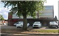
Shops on Brownshill Green Road, Coundon
Image: © David Howard
Taken: 21 May 2023
0.07 miles
3
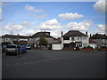
South end of Birchfield Road, Radford
At its junction with Norman Place Road.
Image: © Richard Vince
Taken: 2 Apr 2016
0.08 miles
4
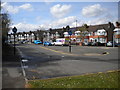
Bus turning circle, Norman Place Road, Coundon (1)
Built into the junction of Norman Place Road and Duncroft Avenue (behind the photographer), this is the one time terminus of route 5 from Coventry city centre, which was extended to Radford many years ago (and has been extended further since); in recent years, this turning circle has merely been a glorified lay by for buses to town. The "buses only" signs are in an odd place as this end of the turning circle is also used by traffic entering and leaving a sports ground out of frame to the left.
Image: © Richard Vince
Taken: 2 Apr 2016
0.15 miles
5
Bus turning circle, Norman Place Road, Coundon (2)
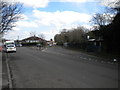
Built into the junction of Norman Place Road (foreground) and Duncroft Avenue (straight ahead), this is the one time terminus of route 5 from Coventry city centre, which was extended to Radford many years ago (and has been extended further since); in recent years, this turning circle has merely been a glorified lay by for buses to town.
Image: © Richard Vince
Taken: 2 Apr 2016
0.16 miles
6
Coventry - Coundon
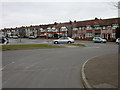
Duncroft Avenue at the entrance to Bablake Playing Fields which is home to Christ the King F.C., Old Wheatleyans R.F.C. and Bablake Old Boys Cricket Club.
Image: © Ian Rob
Taken: 19 Mar 2006
0.18 miles
7

Brownshill Green Rd
A wet grey day in western Coventry. Not the best time to see these rather grey examples of terraced social housing. The uniform grey pebble-dashing seems to monotonise the appearance
Image: © Nigel Mykura
Taken: 4 Mar 2012
0.18 miles
8
Coventry - Coundon
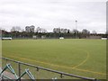
Astroturf pitch at Bablake Playing Fields.
Image: © Ian Rob
Taken: 19 Mar 2006
0.19 miles
9
Wallace Hotel, Radford
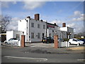
A very substantial pub on the corner of Norman Place Road (foreground) and Keresley Road.
Image: © Richard Vince
Taken: 2 Apr 2016
0.21 miles
10
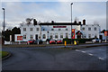
The Wallace Hotel on Keresley Road, Coventry
Image: © Ian S
Taken: 25 Dec 2013
0.22 miles