
IMAGES TAKEN NEAR TO
Ruskin Close, COVENTRY, CV6 1PN
Introduction
This page details the photographs taken nearby to Ruskin Close, CV6 1PN by members of the Geograph project.
The Geograph project started in 2005 with the aim of publishing, organising and preserving representative images for every square kilometre of Great Britain, Ireland and the Isle of Man.

There are currently over 7.5m images from over14,400 individuals and you can help contribute to the project by visiting https://www.geograph.org.uk
Image Map
Images are licensed for reuse under creativecommons.org/licenses/by-sa/2.0
Notes
- Clicking on the map will re-center to the selected point.
- The higher the marker number, the further away the image location is from the centre of the postcode.
Image Listing (11 Images Found)
Images are licensed for reuse under creativecommons.org/licenses/by-sa/2.0
Image
Details
Distance
1
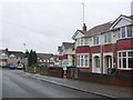
Shorncliffe Rd
These are the last few houses at the southern end of this long residential rd of 1930s terraced housing on the western outskirts of Coventry. This is close to the junction with Kingsbury Rd.
Image: © Nigel Mykura
Taken: 4 Mar 2012
0.06 miles
2
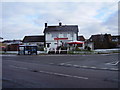
The Brooklands, Kingsbury Road
Situated on what must be the widest crossroads in the area.
Image: © Anthony Vosper
Taken: 11 Feb 2010
0.09 miles
3
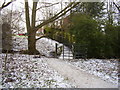
Footbridge over the River Sherbourne
This small footbridge links the Coundon Wedge to Newington Close.
Image: © Anthony Vosper
Taken: 11 Feb 2010
0.10 miles
4
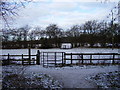
Two gates in the snow
Gates on the Coundon Wedge footpaths.
Image: © Anthony Vosper
Taken: 11 Feb 2010
0.10 miles
5
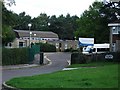
Three Spires School, Kingsbury Road, Coundon
The building on the right is the caretaker's house. The driveway to Coundon Social Club can also just be seen going to the right of the house.
Image: © John Brightley
Taken: 31 Aug 2010
0.12 miles
6
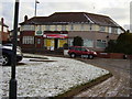
Just one left
1930's Corner shops now reduced to just one.
Image: © Anthony Vosper
Taken: 11 Feb 2010
0.15 miles
7
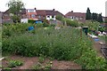
Kingsbury Road allotments, Allesley Park, Coventry.
Looking towards the backs of the houses in Donnington Avenue.
The block of blue plants in the foreground is Phacelia Tanacetefolia, a type of green manure plant that is normally cut down before flowering and dug into the ground to improve the soil, but in this case they have been left to flower as the bees and butterflies love them as they are a great source of nectar.
Image: © Peterson Cobbett
Taken: 9 May 2009
0.22 miles
8
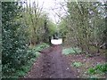
Church Walk, Allesley
This view is taken from near the cemetery Image, looking towards where the path is crossed by the Coundon Wedge road (B4076). Church Walk is signposted as a public bridleway and shows evidence of use by cyclists, horse and pedestrian traffic.
Image: © E Gammie
Taken: 23 Apr 2006
0.23 miles
9
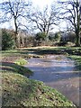
Erosion and deposition
Looking downstream on the river Sherbourne towards the Coundon Wedge road. The bubbles show where the fastest flow is - it heads straight for the small cusp, swirls round a bit and deposits on the right bank where the flow is slower.
Image: © E Gammie
Taken: 11 Feb 2007
0.23 miles
10
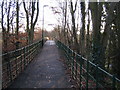
Footbridge across Pickford Way
The footbridge crosses Pickford Way (Allesley bypass). Looking from Allesley village towards Allesley Park.
Image: © John Winterbottom
Taken: 20 Jan 2006
0.24 miles