IMAGES TAKEN NEAR TO
Torbay Road, COVENTRY, CV5 9JY

Introduction

This page details the photographs taken nearby to Torbay Road, CV5 9JY by members of the Geograph project.

The Geograph project started in 2005 with the aim of publishing, organising and preserving representative images for every square kilometre of Great Britain, Ireland and the Isle of Man.

There are currently over 7.5m images from over14,400 individuals and you can help contribute to the project by visiting https://www.geograph.org.uk

Image Map


Images are licensed for reuse under creativecommons.org/licenses/by-sa/2.0
Notes
  • Clicking on the map will re-center to the selected point.
  • The higher the marker number, the further away the image location is from the centre of the postcode.

Image Listing (48 Images Found)

Images are licensed for reuse under creativecommons.org/licenses/by-sa/2.0
  • ...
Image
Details
Distance
1
Victoria Court, Pyt Park
Looking towards one of the Victoria Court blocks of flats from the junction of Pyt Park with Pangfield Park.
Image: © E Gammie Taken: 17 Aug 2014
0.08 miles
2
Rounding the bend
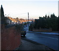
Short terraces of 1950s/60s houses in Torbay Road on Allesley Park estate. Ice still on the pavement where the sun hasn't reached all day. The buildings on the horizon are offices in the city centre.
Image: © E Gammie Taken: 3 Dec 2008
0.09 miles
3
Victoria Court
Blocks of flats off Pangfield Park on the 1960s built Allesley Park estate.
Image: © E Gammie Taken: 30 Jan 2012
0.10 miles
4
Allesley Old Road
At one time there used to be a drive leading off to the left at the cedar trees which led to a property shown on 1936-7 OS maps as High Field. In the 1960s Image] was built on the site, with access from Dulverton Avenue. Surrounding housing is of ca. 1930s vintage and is set several feet above the road. For many years this road was part of a coach route from London to Holyhead and at this point it climbs a low rise between the River Sherbourne and a tributary stream so it is possible that, in the days before adequate road surfaces, the roadway wore down into a holloway.
Image: © E Gammie Taken: 18 Dec 2011
0.13 miles
5
Winsford Avenue, Allesley Park
A sunny Christmas Day after days of wind and heavy rain. Looking down Winsford Avenue towards the shops and, in line with the road, the spires of Holy Trinity and St Michael's in the city centre.
Image: © E Gammie Taken: 25 Dec 2013
0.13 miles
6
Shops, Winsford Avenue
A thriving set of shops on the corner of Winsford Avenue and Whitaker Road. However, on a Sunday it is shutter-land.
Image: © E Gammie Taken: 5 Feb 2012
0.13 miles
7
The Lodge
Allesley Hall Drive. Possibly the lodge to the original hall.
Image: © Anthony Vosper Taken: 12 Feb 2010
0.13 miles
8
Winsford Avenue, Allesley Park
Looking down the drop to the shops at the junction of Whitaker Road and Winsford Avenue (centre). The buses have difficulties on this slope in snowy conditions. The spires of Holy Trinity and St Michaels in Image are visible on the horizon.
Image: © E Gammie Taken: 15 Nov 2007
0.14 miles
9
Dulverton Court
Mid 60's infill on a 1930's avenue. Originally the site was occupied by one single house.
Image: © Anthony Vosper Taken: 11 Feb 2010
0.14 miles
10
Allesley Old Road (B4106) in snow, 1990
On the morning of Saturday 8th December 1990, a heavy localised snowfall accompanied by strong winds caused chaos on the roads in the area. Here, in the afternoon, cars are jammed in the left carriageway, near the junction with Winsford Avenue. Other vehicles are attempting to keep moving by taking the right hand carriageway to get to the junction.
Image: © E Gammie Taken: 8 Dec 1990
0.15 miles
  • ...