IMAGES TAKEN NEAR TO
Antrim Close, COVENTRY, CV5 9FY
Introduction
This page details the photographs taken nearby to Antrim Close, CV5 9FY by members of the Geograph project.
The Geograph project started in 2005 with the aim of publishing, organising and preserving representative images for every square kilometre of Great Britain, Ireland and the Isle of Man.

There are currently over 7.5m images from over14,400 individuals and you can help contribute to the project by visiting https://www.geograph.org.uk
Image Map (Loading...)


Getting Data...Please wait
Leaflet Map data © OpenStreetMap
Images are licensed for reuse under creativecommons.org/licenses/by-sa/2.0
Notes
- Clicking on the map will re-center to the selected point.
- The higher the marker number, the further away the image location is from the centre of the postcode.
Image Listing (25 Images Found)
Images are licensed for reuse under creativecommons.org/licenses/by-sa/2.0
Image
Details
Distance
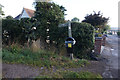
1
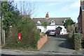
Elizabeth II postbox on Birmingham Road, Allesley
Postbox No. CV5 181.
See Image] for close up.
Image: © JThomas
Taken: 4 Mar 2017
0.17 miles
2
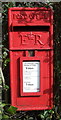
Close up, Elizabeth II postbox on Birmingham Road, Allesley
Postbox No. CV5 181.
See Image] for wider view.
Image: © JThomas
Taken: 4 Mar 2017
0.17 miles
5
Allesley Croft
1960's infill housing on the Holyhead Road. This was once the main route out of the city to Birmingham. This was replaced by a bypass to the west.
Image: © Anthony Vosper
Taken: 22 Jun 2013
0.18 miles
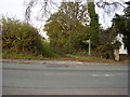
6
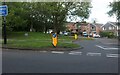
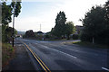
Birmingham Road at the junction of Allesley Croft
Image: © David Howard
Taken: 21 May 2023
0.18 miles
7
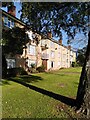
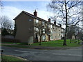
Flats, Birmingham Road, Allesley
These council flats in Allesley resemble the ones built around 1950 by the Coventry Corporation City Architect's department under Donald Gibson in the Stonebridge estate on the south side of the city; see Image The layout is similar, too; some, like these, face onto a green and the main road, others are laid out in monotonous parallel lines, as at Stonebridge.
Image: © A J Paxton
Taken: 15 Oct 2023
0.18 miles
9
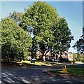
Western approach to Allesley Village
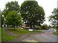
Allesley is a historic Warwickshire village which has become a suburb of Coventry on the city's western edge. A fine ash tree, with a sweet chestnut alongside (to the left in this photo) stand at the junction of Rye Hill and Birmingham Road where visitors enter the village from the west.
Image: © A J Paxton
Taken: 15 Oct 2023
0.18 miles
10
Footpath on The Windmill Hill
This path will take you across the fields to the Gables Trig point.
Image: © Anthony Vosper
Taken: 29 Oct 2009
0.19 miles