Flats, Birmingham Road, Allesley
Introduction
The photograph on this page of Flats, Birmingham Road, Allesley by A J Paxton as part of the Geograph project.
The Geograph project started in 2005 with the aim of publishing, organising and preserving representative images for every square kilometre of Great Britain, Ireland and the Isle of Man.

There are currently over 7.5m images from over 14,400 individuals and you can help contribute to the project by visiting https://www.geograph.org.uk
Flats, Birmingham Road, Allesley
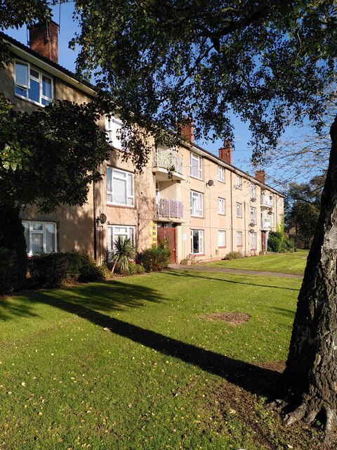
Image: © A J Paxton Taken: 15 Oct 2023
These council flats in Allesley resemble the ones built around 1950 by the Coventry Corporation City Architect's department under Donald Gibson in the Stonebridge estate on the south side of the city; see Image The layout is similar, too; some, like these, face onto a green and the main road, others are laid out in monotonous parallel lines, as at Stonebridge.
Images are licensed for reuse under creativecommons.org/licenses/by-sa/2.0
Image Location
Latitude
52.424799
Longitude
-1.567063