
IMAGES TAKEN NEAR TO
Browns Lane, COVENTRY, CV5 9EH
Introduction
This page details the photographs taken nearby to Browns Lane, CV5 9EH by members of the Geograph project.
The Geograph project started in 2005 with the aim of publishing, organising and preserving representative images for every square kilometre of Great Britain, Ireland and the Isle of Man.

There are currently over 7.5m images from over14,400 individuals and you can help contribute to the project by visiting https://www.geograph.org.uk
Image Map
Images are licensed for reuse under creativecommons.org/licenses/by-sa/2.0
Notes
- Clicking on the map will re-center to the selected point.
- The higher the marker number, the further away the image location is from the centre of the postcode.
Image Listing (22 Images Found)
Images are licensed for reuse under creativecommons.org/licenses/by-sa/2.0
Image
Details
Distance
1
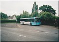
Bus in turning circle, Brownshill Green
Travel Coventry 1569, a Mercedes-Benz O.405N, stands in the turning circle near the north end of Browns Lane, having just arrived on route 7 from Coventry city centre.
Image: © Richard Vince
Taken: 12 Jun 2008
0.03 miles
2
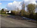
The end of the road
The terminus for the local No7 bus service at Brownshill Green.
Image: © Anthony Vosper
Taken: 10 Feb 2010
0.04 miles
3
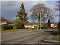
Brownshill Green
Approaching the village at the junction of Browns Lane and Hawkes Mill Lane.
Image: © Anthony Vosper
Taken: 10 Feb 2010
0.06 miles
4
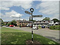
Direction Sign – Signpost on Hawkes Mill Lane, Brownshill Green
Located at Brownshill Green, Coventry, on the southwest side of the junction of Hawkes Mill Lane and Browns Lane. 3 arms and annulus finial.
Milestone Society National ID: WA_SP3082A
Image: © Roadside Relics
Taken: 29 Jun 2023
0.07 miles
5
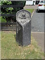
Old Boundary Marker on Hawkes Mill Lane, Brownshill Green
Municipal Boundary Marker outside no.116, on the north side of Hawkes Mill Lane, Brownshill Green, Coventry. Marked CITY OF / COVENTRY in raised lettering on the right-hand face. This location was formerly Allesley parish, but it became the boundary with Coventry in 1932. Now entirely in Coventry. The left-hand face therefore could have been marked PARISH OF / ALLESLEY.
Milestone Society National ID: WA_COVAL4pb
Image: © Roadside Relics
Taken: 29 Jun 2023
0.09 miles
6
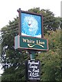
White Lion
A slightly different take on the white lion theme for the pub sign at the White Lion, Brownshill Green.
Image: © E Gammie
Taken: 30 Oct 2006
0.15 miles
7
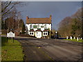
The White Lion
A welcome sight at the junction of Wall Hill Road and Hawkes Mill Lane.
Image: © Anthony Vosper
Taken: 10 Feb 2010
0.17 miles
8
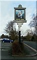
Pub sign, White Lion, Wall Hill Road
The pub occupies the corner of the junction of Hawkes Mill Lane and Wall Hill Road. The sign is at the rear of the pub, at the car park entrance on Wall Hill Road.
Image: © Niki Walton
Taken: 1 Mar 2017
0.18 miles
9
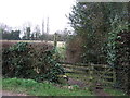
Footpath, Brownshill Green
Off Wall Hill Road.
Image: © JThomas
Taken: 11 Mar 2017
0.18 miles
10
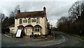
White Lion
At the junction of Hawkes Mill Lane and Wall Hill Road.
Image: © Niki Walton
Taken: 1 Mar 2017
0.18 miles