Old Boundary Marker on Hawkes Mill Lane, Brownshill Green
Introduction
The photograph on this page of Old Boundary Marker on Hawkes Mill Lane, Brownshill Green by Roadside Relics as part of the Geograph project.
The Geograph project started in 2005 with the aim of publishing, organising and preserving representative images for every square kilometre of Great Britain, Ireland and the Isle of Man.

There are currently over 7.5m images from over 14,400 individuals and you can help contribute to the project by visiting https://www.geograph.org.uk
Old Boundary Marker on Hawkes Mill Lane, Brownshill Green
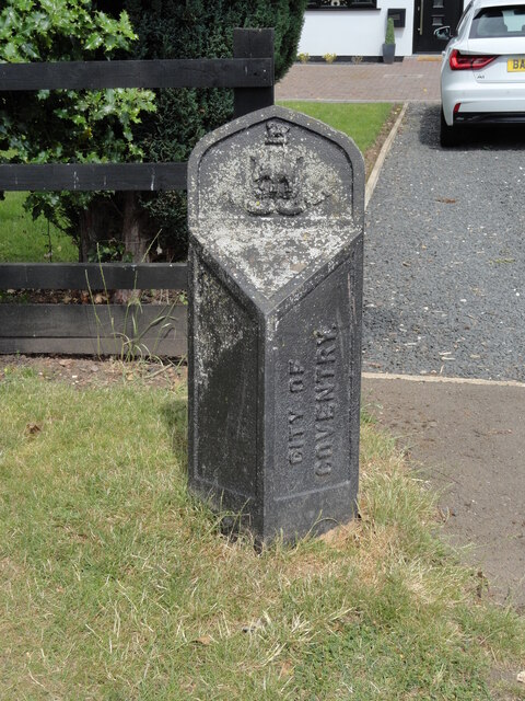
Image: © Roadside Relics Taken: 29 Jun 2023
Municipal Boundary Marker outside no.116, on the north side of Hawkes Mill Lane, Brownshill Green, Coventry. Marked CITY OF / COVENTRY in raised lettering on the right-hand face. This location was formerly Allesley parish, but it became the boundary with Coventry in 1932. Now entirely in Coventry. The left-hand face therefore could have been marked PARISH OF / ALLESLEY. Milestone Society National ID: WA_COVAL4pb
Images are licensed for reuse under creativecommons.org/licenses/by-sa/2.0
Image Location
Latitude
52.441805
Longitude
-1.556363