
IMAGES TAKEN NEAR TO
Gardenia Drive, COVENTRY, CV5 9BN
Introduction
This page details the photographs taken nearby to Gardenia Drive, CV5 9BN by members of the Geograph project.
The Geograph project started in 2005 with the aim of publishing, organising and preserving representative images for every square kilometre of Great Britain, Ireland and the Isle of Man.

There are currently over 7.5m images from over14,400 individuals and you can help contribute to the project by visiting https://www.geograph.org.uk
Image Map
Images are licensed for reuse under creativecommons.org/licenses/by-sa/2.0
Notes
- Clicking on the map will re-center to the selected point.
- The higher the marker number, the further away the image location is from the centre of the postcode.
Image Listing (30 Images Found)
Images are licensed for reuse under creativecommons.org/licenses/by-sa/2.0
Image
Details
Distance
1
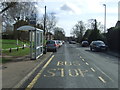
Bus stop and shelter on Birmingham Road, Allesley
Looking south east.
Image: © JThomas
Taken: 4 Mar 2017
0.07 miles
2
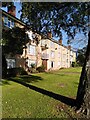
Flats, Birmingham Road, Allesley
These council flats in Allesley resemble the ones built around 1950 by the Coventry Corporation City Architect's department under Donald Gibson in the Stonebridge estate on the south side of the city; see Image The layout is similar, too; some, like these, face onto a green and the main road, others are laid out in monotonous parallel lines, as at Stonebridge.
Image: © A J Paxton
Taken: 15 Oct 2023
0.08 miles
4
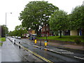
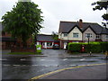
Flaming June!
The village shops in Birmingham road, Allesley.
This was once the main route from Coventry to Birmingham.
Another wet day in Jubilee week.
Image: © Anthony Vosper
Taken: 8 Jun 2012
0.11 miles
5
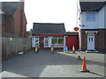
Allesley village Post Office
Still serving the community in Birmingham Road.
Image: © Anthony Vosper
Taken: 8 Jun 2012
0.11 miles
7
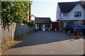
Allesley Post Office
Birmingham Road, Allesley.
Image: © Ian S
Taken: 26 Aug 2019
0.12 miles
8
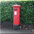
George V postbox on Birmingham Road, Allesley
Outside the Post Office.
Postbox No. CV5 33.
Image: © JThomas
Taken: 4 Mar 2017
0.12 miles
9
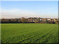
Allesley village and Coventry Hill Hotel
Taken from Allesley Park (foreground). Coventry Hill Hotel centre horizon, Allesley village to the right. The houses shown were built during the expansion of the village in the latter half of the 20th century. It is within the Coventry boundary but maintains an independent character.
Image: © E Gammie
Taken: 15 Nov 2007
0.13 miles
10
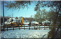
Snow clearance at Pickford Way
Sunday 9th December 1990, the morning after a major snowfall paralysed the roads in the area. The Dunchurch Highway (A45) between here, the Pickford Way junction, and Broad Lane was closed overnight due to several vehicles having been unable to negotiate the undulating profile. Work is under way to clear the road and free the vehicles stuck here overnight.
Image: © E Gammie
Taken: 9 Dec 1990
0.14 miles