
IMAGES TAKEN NEAR TO
Pavilion Way, COVENTRY, CV5 8PF
Introduction
This page details the photographs taken nearby to Pavilion Way, CV5 8PF by members of the Geograph project.
The Geograph project started in 2005 with the aim of publishing, organising and preserving representative images for every square kilometre of Great Britain, Ireland and the Isle of Man.

There are currently over 7.5m images from over14,400 individuals and you can help contribute to the project by visiting https://www.geograph.org.uk
Image Map
Images are licensed for reuse under creativecommons.org/licenses/by-sa/2.0
Notes
- Clicking on the map will re-center to the selected point.
- The higher the marker number, the further away the image location is from the centre of the postcode.
Image Listing (54 Images Found)
Images are licensed for reuse under creativecommons.org/licenses/by-sa/2.0
Image
Details
Distance
1
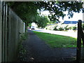
Service Road behind the Alvis Retail Park
Image: © Keith Williams
Taken: 29 May 2015
0.01 miles
2
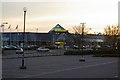
Morrison's on the Alvis Retail Park
The retail park is named after the Alvis factory that was previously on the site.
Image: © Keith Williams
Taken: 21 Apr 2008
0.06 miles
3
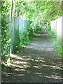
Footpath behind the Alvis Retail Park
Image: © Keith Williams
Taken: 29 May 2015
0.06 miles
4
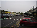
Morrison's Car park
Built on the former site of the Alvis car manufactures.
Two of Coventry's famous three spires can just be seen in the background.
Image: © Anthony Vosper
Taken: 7 Jun 2014
0.08 miles
5
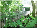
Footbridge over the River Sherbourne
Image: © Keith Williams
Taken: 29 May 2015
0.11 miles
6
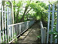
Footbridge over the River Sherbourne
Image: © Keith Williams
Taken: 29 May 2015
0.11 miles
7
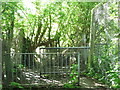
Footpath behind the Arches Industrial Estate
Image: © Keith Williams
Taken: 29 May 2015
0.11 miles
8
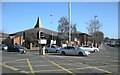
Coventry-Holyhead Road
At the junction with Moseley Avenue.Holyhead Road United Reformed Church is on the corner.
Image: © Ian Rob
Taken: 7 Mar 2011
0.12 miles
9
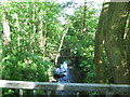
River Sherbourne behind the Arches Industrial Estate
Image: © Keith Williams
Taken: 29 May 2015
0.12 miles
10
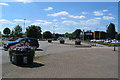
Holyhead Road, Coventry
The Holyhead Road was cut through from the city centre to Allesley as part of the improvements to the London-Holyhead coach route made by Thomas Telford in the 1820s. It was straighter and had a more even gradient than the previous section which went via Spon Street and the Allesley Road (now Allesley Old Road). The photographer's position would have been the centre of the road before the Alvis retail park necessitated changes to the road layout.
Image: © E Gammie
Taken: 21 Jun 2010
0.13 miles