
IMAGES TAKEN NEAR TO
Leyland Road, COVENTRY, CV5 8JB
Introduction
This page details the photographs taken nearby to Leyland Road, CV5 8JB by members of the Geograph project.
The Geograph project started in 2005 with the aim of publishing, organising and preserving representative images for every square kilometre of Great Britain, Ireland and the Isle of Man.

There are currently over 7.5m images from over14,400 individuals and you can help contribute to the project by visiting https://www.geograph.org.uk
Image Map
Images are licensed for reuse under creativecommons.org/licenses/by-sa/2.0
Notes
- Clicking on the map will re-center to the selected point.
- The higher the marker number, the further away the image location is from the centre of the postcode.
Image Listing (45 Images Found)
Images are licensed for reuse under creativecommons.org/licenses/by-sa/2.0
Image
Details
Distance
1
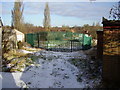
The Green Triangle
Surrounded by Dulverton Avenue, Westbury and Leyland Roads.
This area was originally given over to allotments.
Back in the early '60s the local children would build a huge bonfire for November 5th almost on the site the photograph was taken from.
Image: © Anthony Vosper
Taken: 11 Feb 2010
0.04 miles
2
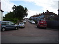
Leyland Road
Typical inter war years housing in Coventry.
Linking Westbury Road to Dulverton Avenue.
Image: © Anthony Vosper
Taken: 18 Aug 2012
0.05 miles
3
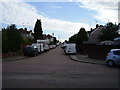
Cranford Road
Typical inter war years housing in Coventry.
Linking Westbury Road to Dulverton Avenue.
Image: © Anthony Vosper
Taken: 18 Aug 2012
0.06 miles
4
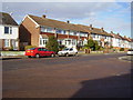
At the top of the hill
Dulverton Avenue, more modern infill in a 1930's avenue, original style houses feature to the right.
Image: © Anthony Vosper
Taken: 11 Feb 2010
0.08 miles
5
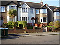
78 Dulverton Avenue
Whilst having a coat of whitewash on its pebble-dash, this is one of the few houses in the avenue to retain most of its 1930's features. Leaded front door and windows. Even one of the original privet hedges still remain.
Image: © Anthony Vosper
Taken: 28 Oct 2009
0.08 miles
6
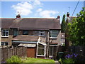
The rear of 74 Dulverton Avenue
The photographer's childhood home.
Up until the late 70's there was a water catchment tank on top of the extension next to the conservatory. These were later removed and replaced with a roof.
Image: © Anthony Vosper
Taken: 3 Jun 2015
0.09 miles
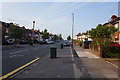
8
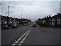
Grayswood Avenue
Looking up hill. In the 1960's both sides of the road were lined with Rowan trees now only a few remain.
Image: © Anthony Vosper
Taken: 28 Apr 2012
0.10 miles
9
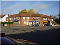
Corner shops
Built in the 1930's situated on the corner of Westbury Road and Grayswood Avenue. At one point had two grocers a wool shop,ladies hairdresser and a butcher.
Image: © Anthony Vosper
Taken: 28 Oct 2009
0.10 miles
10
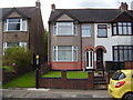
End of an era
74 Dulverton Avenue.My childhood home.
This photograph was taken on the day that my mother moved to go into sheltered accommodation. She had lived in the house for over 61 years.
Image: © Anthony Vosper
Taken: 1 Sep 2015
0.11 miles