
IMAGES TAKEN NEAR TO
Holyhead Road, COVENTRY, CV5 8HW
Introduction
This page details the photographs taken nearby to Holyhead Road, CV5 8HW by members of the Geograph project.
The Geograph project started in 2005 with the aim of publishing, organising and preserving representative images for every square kilometre of Great Britain, Ireland and the Isle of Man.

There are currently over 7.5m images from over14,400 individuals and you can help contribute to the project by visiting https://www.geograph.org.uk
Image Map
Images are licensed for reuse under creativecommons.org/licenses/by-sa/2.0
Notes
- Clicking on the map will re-center to the selected point.
- The higher the marker number, the further away the image location is from the centre of the postcode.
Image Listing (50 Images Found)
Images are licensed for reuse under creativecommons.org/licenses/by-sa/2.0
Image
Details
Distance
1
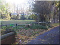
The Coundon Wedge
A small Greenbelt area, crossed by a number of footpaths. The river Sherbourne runs to the left out of picture.
Image: © Anthony Vosper
Taken: 28 Oct 2009
0.04 miles
2
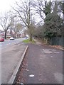
Holyhead Road and lay-by
At this point the river Sherbourne runs very close to the road and a plaque on the fencing informs us that "this lay-by was originally constructed to enable water to be taken from the river Sherbourne by steam lorries operating from the flour mill in Cox Street. It was in use until circa 1949". This may be the flour mill referred to: http://www.geograph.org.uk/photo/2266454 .
The Holyhead Road (A4114) was part of the London to Holyhead turnpike system and this straight bit between the city centre and Allesley bypassed the old Allesley road - now called the Allesley Old Road. Still a main artery out of the city, it is provided with on-road cycle lanes.
Image: © E Gammie
Taken: 25 Dec 2008
0.05 miles
3
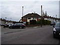
1960's Infill
Junction of Westbury Road and Dulverton Avenue. The rest of the area was built in the early 1930's, this until the early 1960's was empty.
Each year in November the local children would build a bonfire on this site.
Image: © Anthony Vosper
Taken: 28 Apr 2012
0.08 miles
4
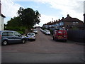
Leyland Road
Typical inter war years housing in Coventry.
Linking Westbury Road to Dulverton Avenue.
Image: © Anthony Vosper
Taken: 18 Aug 2012
0.09 miles
5
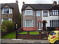
End of an era
74 Dulverton Avenue.My childhood home.
This photograph was taken on the day that my mother moved to go into sheltered accommodation. She had lived in the house for over 61 years.
Image: © Anthony Vosper
Taken: 1 Sep 2015
0.11 miles
6
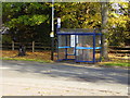
Waiting for the bus
The Toll Gate and Dulverton Avenue stop for the local bus service.
Image: © Anthony Vosper
Taken: 28 Oct 2009
0.12 miles
7
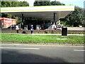
Holyhead Road Filling Station
On the A4114.
Image: © Gerald England
Taken: 26 Sep 2021
0.12 miles
8
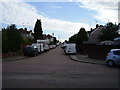
Cranford Road
Typical inter war years housing in Coventry.
Linking Westbury Road to Dulverton Avenue.
Image: © Anthony Vosper
Taken: 18 Aug 2012
0.12 miles
9
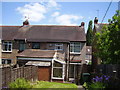
The rear of 74 Dulverton Avenue
The photographer's childhood home.
Up until the late 70's there was a water catchment tank on top of the extension next to the conservatory. These were later removed and replaced with a roof.
Image: © Anthony Vosper
Taken: 3 Jun 2015
0.13 miles
10
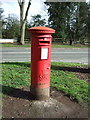
George VI postbox on Holyhead Road, Coventry
Postbox No. CV5 288.
See Image] for context.
Image: © JThomas
Taken: 4 Mar 2017
0.13 miles