1
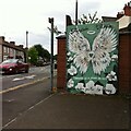
Abercorn Road, Coventry
Image: © Alan Hughes
Taken: 23 Sep 2021
0.01 miles
2
164 Allesley Old Road
A former watch making premises, identified by the Coventry Watch Museum Project plaque, shown here
Image
This is the 15th site on the Coventry Watchmakers' Heritage Trail.
The 16th site is at 51 Allesley Old Road,
Image, which is currently being redeveloped, and not displaying a plaque.
The 17th site on the trail is
Image
The prior site on the trail is
Image
Image: © Keith Williams
Taken: 4 Apr 2009
0.07 miles
3
Storefront mosque on Allesley Old Road
A single-storey commercial building on a main road out of Coventry, dated 1929 on the parapet, and now in use as a mosque and madrassah (Islamic school).
Image: © A J Paxton
Taken: 2 Sep 2018
0.07 miles
4
Chapel Fields, Coventry
Looking east along Allesley Old road with the local shops and The Maudslay on the left.
Image: © David Stowell
Taken: 23 Jul 2005
0.07 miles
5
Allesley Old Road, Coventry
In Chapel Fields, looking west.
Image: © David Stowell
Taken: 23 Jul 2005
0.07 miles
6
Allesley Old Road, Chapelfields, Coventry
Allesley Old Road, looking towards the junction with Four Pounds Avenue and Queensland Road. Until the 1920s this was on the western fringe of the city, with a handful of houses along the road beyond the watchmaking district of Chapelfields. The rendered 19th century house at the far right of the picture bears a plaque erected by the Coventry Watch Museum Project, indicating that this was Cambrian House, site of the watchmakers W H Adams and Son from 1889 to 1953. In the 1920s and 1930s this stretch of the road and the fields behind were filled with housing, shop units and the occasional roadside pub like the Maudslay, not visible here. A single-storey shop unit dated 1929 on the parapet, formerly Enchanted Interiors, now houses the Iqra Learning Centre, a mosque.
Image: © A J Paxton
Taken: 12 Jun 2021
0.07 miles
7
Coventry Watch Museum Project plaque on 164 Allesley Old Road
Image: © Keith Williams
Taken: 4 Apr 2009
0.07 miles
8
The Maudslay, Allesley Old Road
Image: © Keith Williams
Taken: 30 Apr 2015
0.07 miles
9
The Maudslay, Allesley Old Road
Image: © Keith Williams
Taken: 30 Apr 2015
0.07 miles
10
Love where you live: Queensland Avenue, Whoberley
"Love where you live, stop littering." The mural advertises the neighbouring flower shop and shares its colour scheme. The artist is Katie Sullivan of Katie-O-Art.
Image: © A J Paxton
Taken: 29 Jul 2022
0.08 miles


