Allesley Old Road, Chapelfields, Coventry
Introduction
The photograph on this page of Allesley Old Road, Chapelfields, Coventry by A J Paxton as part of the Geograph project.
The Geograph project started in 2005 with the aim of publishing, organising and preserving representative images for every square kilometre of Great Britain, Ireland and the Isle of Man.

There are currently over 7.5m images from over 14,400 individuals and you can help contribute to the project by visiting https://www.geograph.org.uk
Allesley Old Road, Chapelfields, Coventry
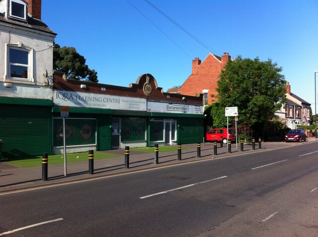
Image: © A J Paxton Taken: 12 Jun 2021
Allesley Old Road, looking towards the junction with Four Pounds Avenue and Queensland Road. Until the 1920s this was on the western fringe of the city, with a handful of houses along the road beyond the watchmaking district of Chapelfields. The rendered 19th century house at the far right of the picture bears a plaque erected by the Coventry Watch Museum Project, indicating that this was Cambrian House, site of the watchmakers W H Adams and Son from 1889 to 1953. In the 1920s and 1930s this stretch of the road and the fields behind were filled with housing, shop units and the occasional roadside pub like the Maudslay, not visible here. A single-storey shop unit dated 1929 on the parapet, formerly Enchanted Interiors, now houses the Iqra Learning Centre, a mosque.
Images are licensed for reuse under creativecommons.org/licenses/by-sa/2.0
Image Location
Latitude
52.408373
Longitude
-1.53822