
IMAGES TAKEN NEAR TO
Lyndale Road, COVENTRY, CV5 8AX
Introduction
This page details the photographs taken nearby to Lyndale Road, CV5 8AX by members of the Geograph project.
The Geograph project started in 2005 with the aim of publishing, organising and preserving representative images for every square kilometre of Great Britain, Ireland and the Isle of Man.

There are currently over 7.5m images from over14,400 individuals and you can help contribute to the project by visiting https://www.geograph.org.uk
Image Map
Images are licensed for reuse under creativecommons.org/licenses/by-sa/2.0
Notes
- Clicking on the map will re-center to the selected point.
- The higher the marker number, the further away the image location is from the centre of the postcode.
Image Listing (77 Images Found)
Images are licensed for reuse under creativecommons.org/licenses/by-sa/2.0
Image
Details
Distance
1
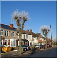
Pollarded trees, Glendower Avenue
Frost on the new tips of the annually pollarded trees. The houses show two periods of building in Glendower Avenue. Those to the left are 1920s/30s built, whilst those to the right are of a later date, post WW2.
Image: © E Gammie
Taken: 7 Dec 2010
0.07 miles
2
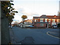
Glendower Avenue
A former shop on the corner with Whoberley Avenue, converted to residential use.
Image: © E Gammie
Taken: 7 Nov 2010
0.07 miles
3
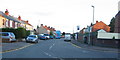
Whoberley Avenue
A Sunday afternoon and, unusually, a double decker bus is making its way into town in contrast to weekday commuting times when it's a closely packed single-decker.
Image: © E Gammie
Taken: 7 Nov 2010
0.07 miles
4
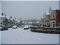
Gorseway at Heathfield Road
Looking east along Gorseway from the junction with Heathfield Road. It had been snowing steadily all morning and reached about 10cm by this time.
The housing here is short bay-windowed terraces dating from the 1930s, typical of many of Coventry's suburbs. The trees beyond the houses are on Hearsall Common.
Image: © E Gammie
Taken: 18 Jan 2013
0.08 miles
5
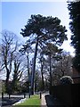
Scots pine, Guphill Ave
The overnight snow has melted in the sunlight but remains on the north side of the pine and in the shadows.
Image: © E Gammie
Taken: 6 Apr 2008
0.09 miles
6
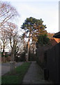
Guphill Avenue
Looking towards Hearsall Common woodland. The Scots pine on the corner is one of several dotted along Guphill Avenue. On old OS maps Guphill Avenue is shown as Whoberley Lane and was the main approach to Whoberley Hall. The road has been closed to motor traffic other than for access to prevent it being used as a rat-run to avoid the Glendower Avenue / Broad Lane traffic light hold up.
Image: © E Gammie
Taken: 27 Jan 2008
0.09 miles
7
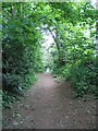
Urban bridleway
This public bridleway runs parallel to Glendower Avenue between the corner of Guphill Avenue and Allesley Old Road. It is shown on the 1889 OS map as Guphill Lane and ran from Whoberley Lane (now Guphill Avenue) to join what was then called the Old Allesley Road at Guphill Ford Bridge. It was on the western boundary of the city between the boundary changes of 1842 and 1928.
Image: © E Gammie
Taken: 4 May 2007
0.10 miles
8
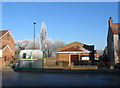
Christadelphian hall, Whoberley Avenue
To the left of the bus stop is the entrance to Guphill Lane bridleway.
A similar view (April 2008): http://www.geograph.org.uk/photo/765784
Image: © E Gammie
Taken: 7 Dec 2010
0.10 miles
9
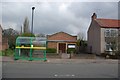
West Coventry Christadelphian Ecclesia, Whoberley Avenue
Image: © Keith Williams
Taken: 16 Apr 2008
0.11 miles
10
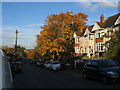
Glendower Avenue
Maples showing autumn colour in Glendower Avenue. The houses in the foreground are in a short terrace of bay windowed properties typical of many built in Coventry suburbs in the late 1920s to 1930s.
Image: © E Gammie
Taken: 28 Oct 2015
0.11 miles