
IMAGES TAKEN NEAR TO
Wiltshire Close, COVENTRY, CV5 7JD
Introduction
This page details the photographs taken nearby to Wiltshire Close, CV5 7JD by members of the Geograph project.
The Geograph project started in 2005 with the aim of publishing, organising and preserving representative images for every square kilometre of Great Britain, Ireland and the Isle of Man.

There are currently over 7.5m images from over14,400 individuals and you can help contribute to the project by visiting https://www.geograph.org.uk
Image Map
Images are licensed for reuse under creativecommons.org/licenses/by-sa/2.0
Notes
- Clicking on the map will re-center to the selected point.
- The higher the marker number, the further away the image location is from the centre of the postcode.
Image Listing (50 Images Found)
Images are licensed for reuse under creativecommons.org/licenses/by-sa/2.0
Image
Details
Distance
4

A45 empty of traffic, 1990
The day after a sudden very localised heavy snowfall - one of the rare occasions one can stand in a carriageway of the A45 without risk to life and limb. What you can't see is the large number of stranded articulated lorries coaches etc. that failed to make this rise by Allesley Park (on the left).
Image: © E Gammie
Taken: 9 Dec 1990
0.09 miles
5
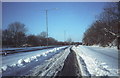
Abandoned vehicle, Dunchurch Highway
Sunday 9th December 1990, the morning after a major snowfall paralysed the roads in the area. The Dunchurch Highway (A45) between Broad Lane and Pickford Way was closed overnight, the undulating profile having caused the undoing of several vehicles including this one at the top of the rise by Allesley Park
Image: © E Gammie
Taken: 9 Dec 1990
0.10 miles
6
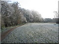
Brookstray, Mount Nod
A narrow strip of green runs alongside the brook behind Nod Rise. A mixed day of heavy frost, fog and bright sunlight.
Image: © E Gammie
Taken: 6 Dec 2010
0.10 miles
8
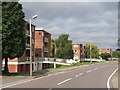
Lower Eastern Green, Coventry
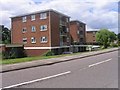
These blocks of flats on Nod Rise are well maintained and sit in nicely tended grounds making up for their rather bland and rectangular design.
Image: © David Stowell
Taken: 29 Aug 2005
0.13 miles
9
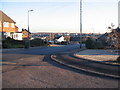
Buckingham Rise, Allesley Park
Looking down Buckingham Rise as it drops steeply away to the brookstray and across to Whoberley. The trees on the horizon are in Hearsall Common at SP3078.
Image: © E Gammie
Taken: 3 Dec 2008
0.14 miles
10
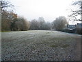
Brookstray, Mount Nod
Closes off Mount Nod Way end at the green alongside the brook.
Image: © E Gammie
Taken: 6 Dec 2010
0.14 miles