
IMAGES TAKEN NEAR TO
Broad Lane, COVENTRY, CV5 7AT
Introduction
This page details the photographs taken nearby to Broad Lane, CV5 7AT by members of the Geograph project.
The Geograph project started in 2005 with the aim of publishing, organising and preserving representative images for every square kilometre of Great Britain, Ireland and the Isle of Man.

There are currently over 7.5m images from over14,400 individuals and you can help contribute to the project by visiting https://www.geograph.org.uk
Image Map
Images are licensed for reuse under creativecommons.org/licenses/by-sa/2.0
Notes
- Clicking on the map will re-center to the selected point.
- The higher the marker number, the further away the image location is from the centre of the postcode.
Image Listing (35 Images Found)
Images are licensed for reuse under creativecommons.org/licenses/by-sa/2.0
Image
Details
Distance
1

Oak, Broad Lane
On the verge in front of 1950s/60s detached houses on the north side of Broad Lane.
Image: © E Gammie
Taken: 12 Dec 2011
0.12 miles
2
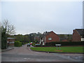
Bishopton Close, Mount Nod
A cul-de-sac leading down towards the brookstray from Mount Nod Way. St John Vianney RC church is on the left. The mast on the horizon is the Allesley Park relay for the Sutton Coldfield transmitter - note the height of the television aerial on a house in Bishopton Close
Image: © E Gammie
Taken: 29 Apr 2012
0.12 miles
3
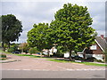
Mount Nod, Coventry
Looking west at the junction of Mount Nod Way with Nod Rise.
Image: © David Stowell
Taken: 29 Aug 2005
0.13 miles
4
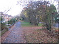
Footway, Broad Lane
The pavement runs behind an old hedgerow on this part of Broad Lane. The houses on the left are detached dwellings, constructed in the 1950s/60s.
Image: © E Gammie
Taken: 16 Nov 2008
0.13 miles
5
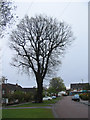
Tree, Mount Nod Way
Looking towards Nod Rise and its two shops.
Image: © E Gammie
Taken: 29 Apr 2012
0.14 miles
6
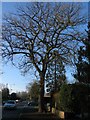
Oak, Broad Lane
On the north side of Broad Lane by the junction with Nod Rise.
Image: © E Gammie
Taken: 12 Dec 2011
0.15 miles
7
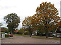
Mount Nod Way, Eastern Green
At the junction with Nod Rise. Comparison with a 2005 photo of the same location ( http://www.geograph.org.uk/photo/48249 ) shows that the street lights have been replaced and the road markings aren't what they were.
Image: © E Gammie
Taken: 25 Oct 2011
0.16 miles
8
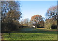
Brookstray and oak
The oak stands between the end of Pebworth Close and the brook.
Image: © E Gammie
Taken: 29 Nov 2016
0.16 miles
9
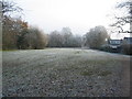
Brookstray, Mount Nod
Closes off Mount Nod Way end at the green alongside the brook.
Image: © E Gammie
Taken: 6 Dec 2010
0.17 miles
10
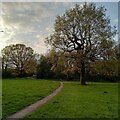
Path to the Guphill Brook, Mount Nod
The Guphill Brook flows through the western Coventry suburbs of Upper & Lower Eastern Green and Whoberley, before joining the River Sherbourne at Lake View Park. The valley was built up with housing in the mid 20th century, with the floodplain around the brook providing a green corridor, approached here along a path off Bishopton Close behind St John Vianney church. The area is known as Mount Nod, after a farm that once stood on Broad Lane.
Image: © A J Paxton
Taken: 26 Apr 2023
0.17 miles