
IMAGES TAKEN NEAR TO
Albany Road, COVENTRY, CV5 6NG
Introduction
This page details the photographs taken nearby to Albany Road, CV5 6NG by members of the Geograph project.
The Geograph project started in 2005 with the aim of publishing, organising and preserving representative images for every square kilometre of Great Britain, Ireland and the Isle of Man.

There are currently over 7.5m images from over14,400 individuals and you can help contribute to the project by visiting https://www.geograph.org.uk
Image Map
Images are licensed for reuse under creativecommons.org/licenses/by-sa/2.0
Notes
- Clicking on the map will re-center to the selected point.
- The higher the marker number, the further away the image location is from the centre of the postcode.
Image Listing (147 Images Found)
Images are licensed for reuse under creativecommons.org/licenses/by-sa/2.0
Image
Details
Distance
1
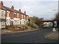
Coventry-Earlsdon
The bridge over Albany Road carrying the Coventry-Birmingham line.
Image: © Ian Rob
Taken: 16 Nov 2007
0.01 miles
2
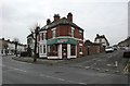
Earlsdon-Albany Road
Chinese Takeaway on the corner of Newcombe Road.
Image: © Ian Rob
Taken: 23 Jan 2011
0.01 miles
3
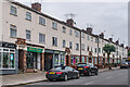
Albany Road
c.1930s terrace, first shown on the 1944 6 inch map, later than the rest of Albany Road.
Image: © Ian Capper
Taken: 25 Sep 2021
0.02 miles
4
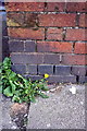
Benchmark on wall fronting #183 Albany Road
Ordnance Survey cut mark benchmark described on the Bench Mark Database at http://www.bench-marks.org.uk/bm75419
Image: © Roger Templeman
Taken: 3 May 2016
0.02 miles
5
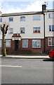
Albany Road houses
There is an OS benchmark Image on the wall in front of #183
Image: © Roger Templeman
Taken: 3 May 2016
0.02 miles
6
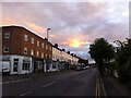
Albany Road at dusk
The top stretch of Albany Road in Earlsdon, looking towards the clock roundabout and Earlsdon Street.
Image: © A J Paxton
Taken: 6 Jun 2020
0.02 miles
7
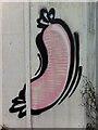
Sausage mural
Painted on boards in alleyway behind Albany Road, Earlsdon.
Image: © A J Paxton
Taken: 11 Aug 2020
0.02 miles
8

Newcombe Rd
View east along the rows of red brick terraced houses. The houses on the left back on to the London Euston main line railway just west of Coventry station.
Image: © Nigel Mykura
Taken: 13 Aug 2010
0.03 miles
9
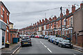
Newcombe Road
Early 20th Century housing, first shown on the 1914 25 inch map. No 72, situated by the lamppost on the right hand side of the road towards the rear of the photo, was where Frank Whittle, inventor of the jet engine, was born on 1 June 1907.
Image: © Ian Capper
Taken: 25 Sep 2021
0.04 miles
10
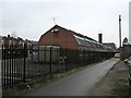
Earlsdon-The Gilbert Richards Centre
Part of a Day Centre owned by Coventry Social Services.
Image: © Ian Rob
Taken: 23 Jan 2011
0.06 miles