
IMAGES TAKEN NEAR TO
St. Andrews Road, COVENTRY, CV5 6JG
Introduction
This page details the photographs taken nearby to St. Andrews Road, CV5 6JG by members of the Geograph project.
The Geograph project started in 2005 with the aim of publishing, organising and preserving representative images for every square kilometre of Great Britain, Ireland and the Isle of Man.

There are currently over 7.5m images from over14,400 individuals and you can help contribute to the project by visiting https://www.geograph.org.uk
Image Map
Images are licensed for reuse under creativecommons.org/licenses/by-sa/2.0
Notes
- Clicking on the map will re-center to the selected point.
- The higher the marker number, the further away the image location is from the centre of the postcode.
Image Listing (99 Images Found)
Images are licensed for reuse under creativecommons.org/licenses/by-sa/2.0
Image
Details
Distance
1
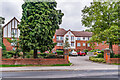
Montes Court
Retirement housing built in 2008 on the site of a number of houses in St Andrew's Road. The gardens of these houses backed on to Beechwood Avenue, with Montes Court being given entrances on both roads.
Image: © Ian Capper
Taken: 25 Sep 2021
0.00 miles
2
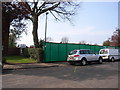
Building site adjacent to Leaholme Court, St.Andrew's Road
The start of construction for a development of McCarthy & Stone retirement apartments.
Image: © John Brightley
Taken: 14 Apr 2007
0.00 miles
3
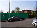
Building site, St.Andrew's Road, Earlsdon
Also see Image]
Image: © John Brightley
Taken: 14 Apr 2007
0.01 miles
4
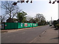
Building site, Beechwood Avenue, Earlsdon
Image: © John Brightley
Taken: 14 Apr 2007
0.01 miles
6
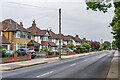
Beechwood Avenue
Road developed out of an old track named Whor Lane, first shown as Beechwood Avenue on the 1913 25 inch map. The houses here are first marked on the 1940 25 inch map, suggesting a building date of the 1920s or 1930s.
Image: © Ian Capper
Taken: 25 Sep 2021
0.03 miles
7
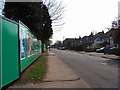
Beechwood Avenue, Earlsdon
Seen from the rear of the McCarthy & Stone building site which also fronts St.Andrew's Road.
Image: © John Brightley
Taken: 14 Apr 2007
0.04 miles
8
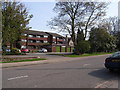
Leaholme Court, Beechwood Avenue
The other side of this building can be seen on Image]
Image: © John Brightley
Taken: 14 Apr 2007
0.04 miles
10
Beechwood Avenue
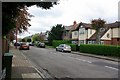
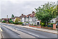
Road developed out of an old track named Whor Lane, first shown as Beechwood Avenue on the 1913 25 inch map. The houses here are first marked on the 1940 25 inch map, suggesting a building date of the 1920s or 1930s.
Image: © Ian Capper
Taken: 25 Sep 2021
0.05 miles