
IMAGES TAKEN NEAR TO
The Riddings, COVENTRY, CV5 6AU
Introduction
This page details the photographs taken nearby to The Riddings, CV5 6AU by members of the Geograph project.
The Geograph project started in 2005 with the aim of publishing, organising and preserving representative images for every square kilometre of Great Britain, Ireland and the Isle of Man.

There are currently over 7.5m images from over14,400 individuals and you can help contribute to the project by visiting https://www.geograph.org.uk
Image Map
Images are licensed for reuse under creativecommons.org/licenses/by-sa/2.0
Notes
- Clicking on the map will re-center to the selected point.
- The higher the marker number, the further away the image location is from the centre of the postcode.
Image Listing (31 Images Found)
Images are licensed for reuse under creativecommons.org/licenses/by-sa/2.0
Image
Details
Distance
1
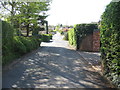
The Riddings, Canley Gardens
One of a set of roads initiated in the 1920s by Canley (Coventry) Garden Society Ltd co-operative as part of a drive to meet post-WWI housing shortages. The road joins Canley Road at the far end but has been closed as a through route for motor vehicles for several years.
Image: © E Gammie
Taken: 6 May 2013
0.08 miles
2
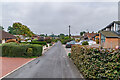
The Riddings
Road first marked on the 1926 6 inch map with very few houses, but with further low density development (or redevelopment) since.
Image: © Ian Capper
Taken: 25 Sep 2021
0.14 miles
3
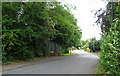
Canley Road
The lower end of Canley Road with the bridge over Canley Brook in the foreground, its sandstone parapet somewhat dominated by a metal fence. One of the lanes in Coventry pre-dating the suburban expansion.
Image: © E Gammie
Taken: 27 May 2010
0.16 miles
4
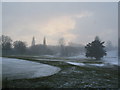
Hearsall golf course
A snow shower over a bleak Hearsall golf course during an unseasonably cold spell in the last week of February.
Image: © E Gammie
Taken: 28 Feb 2018
0.16 miles
5
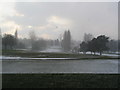
Hearsall golf course
A snow shower over a bleak Hearsall golf course during an unseasonably cold spell in the last week of February.
Image: © E Gammie
Taken: 28 Feb 2018
0.16 miles
6
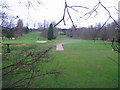
Hearsall golf course
The bottom end of the course taken from the footpath that runs between Bates Road and the lane to Canley Ford.
The course takes the name 'Hearsall' as it originated in 1894 as a 9-hole course on Hearsall Common (SP3178). It moved to its current location off Beechwood Avenue in 1910. During the second world war it was given over to grazing for sheep and cattle.
Image: © E Gammie
Taken: 20 Jan 2008
0.17 miles
8
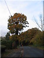
Oaks, Canley Road
A lopped tree, with a long, straight trunk. Smaller oaks on the right border the western edge of Hearsall golf club.
Image: © E Gammie
Taken: 17 Nov 2012
0.19 miles
9
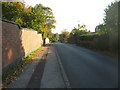
Bates Road, resurfaced
Like many roads in Coventry, Bates Road suffered from the unusually severe ice and snow of winter 2009 and developed several potholes. The solution has been varied: some received an aerosol mark to draw your attention to the hardcore that was being revealed; others received a token dollop of tarmac which will break up after the next icy period; a lucky few, like Bates Road, got completely resurfaced.
The road in May 2010: Image]
Image: © E Gammie
Taken: 11 Oct 2010
0.19 miles
10
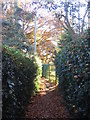
Footpath across Hearsall golf course
Closely fenced on both sides with barely room for two to pass and occasional glimpses of the course though the bars and gates.
Image: © E Gammie
Taken: 28 Nov 2016
0.19 miles