
IMAGES TAKEN NEAR TO
Dorney Close, COVENTRY, CV5 6AN
Introduction
This page details the photographs taken nearby to Dorney Close, CV5 6AN by members of the Geograph project.
The Geograph project started in 2005 with the aim of publishing, organising and preserving representative images for every square kilometre of Great Britain, Ireland and the Isle of Man.

There are currently over 7.5m images from over14,400 individuals and you can help contribute to the project by visiting https://www.geograph.org.uk
Image Map
Images are licensed for reuse under creativecommons.org/licenses/by-sa/2.0
Notes
- Clicking on the map will re-center to the selected point.
- The higher the marker number, the further away the image location is from the centre of the postcode.
Image Listing (49 Images Found)
Images are licensed for reuse under creativecommons.org/licenses/by-sa/2.0
Image
Details
Distance
1
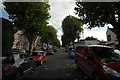
Rochester Road, Earlsdon
The bass player in my band lives here and we regularly shatter the peace of this pleasant leafy avenue by rehearsing in his house. This was taken looking towards Earlsdon.
Image: © John Winder
Taken: 19 Oct 2014
0.10 miles
2
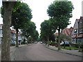
Rochester Road, Earlsdon
A typical quiet suburban street near the middle of the square.
Image: © David Stowell
Taken: 23 Jul 2005
0.11 miles
3
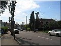
Pollarded planes, Rochester Road
The London Plane trees look somewhat stark after pollarding but regain their good looks later in the year (see http://www.geograph.org.uk/photo/50431 ).
Image: © E Gammie
Taken: 1 Jun 2013
0.12 miles
4
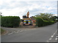
Demolition in Bates Road
The bungalow that stood on this plot at the corner of Bates Road and Innis Road has recently been demolished.
Image: © E Gammie
Taken: 25 Jun 2015
0.13 miles
5
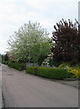
Bates Road
Cherry blossom and shrubs in gardens on Bates Road.
Image: © E Gammie
Taken: 2 May 2010
0.13 miles
7
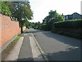
Late summer, Bates Road
A cul de sac road, mostly bungalows.
In 2010: Image
Image: © E Gammie
Taken: 22 Aug 2021
0.15 miles
8
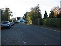
The house at the corner
At the white house Beechwood Avenue turns sharp right and is joined from the left by Bates Road and an access road.
Image: © E Gammie
Taken: 17 Nov 2011
0.15 miles
9
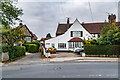
Beechwood Avenue
Road developed out of an old track named Whor Lane, first shown as Beechwood Avenue on the 1913 25 inch map. The house on the left of this photo is also shown on that map, whilst that on the right is first marked on the 1940 25 inch map, suggesting a building date of the 1920s or 1930s. This house was originally built as a single detached house but converted into two residences in the 1960s.
Image: © Ian Capper
Taken: 25 Sep 2021
0.15 miles
10
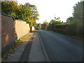
Bates Road, resurfaced
Like many roads in Coventry, Bates Road suffered from the unusually severe ice and snow of winter 2009 and developed several potholes. The solution has been varied: some received an aerosol mark to draw your attention to the hardcore that was being revealed; others received a token dollop of tarmac which will break up after the next icy period; a lucky few, like Bates Road, got completely resurfaced.
The road in May 2010: Image]
Image: © E Gammie
Taken: 11 Oct 2010
0.16 miles