
IMAGES TAKEN NEAR TO
Finham Grove, COVENTRY, CV3 6PN
Introduction
This page details the photographs taken nearby to Finham Grove, CV3 6PN by members of the Geograph project.
The Geograph project started in 2005 with the aim of publishing, organising and preserving representative images for every square kilometre of Great Britain, Ireland and the Isle of Man.

There are currently over 7.5m images from over14,400 individuals and you can help contribute to the project by visiting https://www.geograph.org.uk
Image Map
Images are licensed for reuse under creativecommons.org/licenses/by-sa/2.0
Notes
- Clicking on the map will re-center to the selected point.
- The higher the marker number, the further away the image location is from the centre of the postcode.
Image Listing (16 Images Found)
Images are licensed for reuse under creativecommons.org/licenses/by-sa/2.0
Image
Details
Distance
1
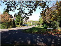
The junction of Grange Avenue and Howes Lane, Finham
Image: © John Brightley
Taken: 20 Oct 2010
0.05 miles
3
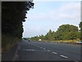
Lay-by on A46 south of Coventry
A shallow lay-by, offering little protection from the traffic on the dual carriageway
Image: © David Smith
Taken: 21 Jul 2013
0.10 miles
4
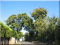
The summit of Howes Lane
Howes Lane (B4115) forms part of Coventry city boundary. Here it crosses a low ridge that juts out between the river Sowe and Finham brook. The oak trees are a reminder of its former rural nature but beyond the hedgerow on the right traffic roars by on the A46 bypass.
Image: © E Gammie
Taken: 14 Oct 2011
0.15 miles
5
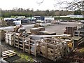
Hard landscape materials, Russell's Nursery
The nursery and its landscaped gardens occupy an extensive site beside the River Sowe.
Image: © Robin Stott
Taken: 22 Nov 2009
0.16 miles
6
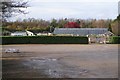
Russell's Nursery and car park
The nursery and its landscaped gardens occupy an extensive site beside the River Sowe.
Image: © Robin Stott
Taken: 22 Nov 2009
0.16 miles

8
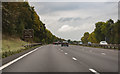
A46 heading south west
Near to Coventry Golf Club.
Image: © J.Hannan-Briggs
Taken: 13 Oct 2016
0.19 miles
9
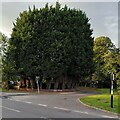
The Streisand Effect
Planting a screen of fast-growing leylandii trees to screen the garden serves to draw attention to it and makes passers-by wonder what lies beyond. This is an example of the Streisand Effect, named after Barbra Streisand's attempts to have an aerial photo of her clifftop California mansion removed from a website documenting coastal erosion, attempts which had the perverse effect of publicising the photo.
The hedge can be seen at the junction of Green Lane and St Martin's Road, on the southern tip of Coventry. On the Streisand Effect see Wikipedia https://en.m.wikipedia.org/wiki/Streisand_effect .
Image: © A J Paxton
Taken: 19 Aug 2023
0.20 miles
10
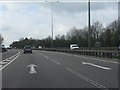
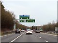
A46 south of Stivichall junction
Lane 1 ahead is a lane gain from the A45 slip road. The A46 continues as a 3-lane highway (D3 standard) from this point to the A429 Warwick exit.
Image: © Peter Whatley
Taken: 3 Apr 2012
0.21 miles