
IMAGES TAKEN NEAR TO
Green Lane, COVENTRY, CV3 6EL
Introduction
This page details the photographs taken nearby to Green Lane, CV3 6EL by members of the Geograph project.
The Geograph project started in 2005 with the aim of publishing, organising and preserving representative images for every square kilometre of Great Britain, Ireland and the Isle of Man.

There are currently over 7.5m images from over14,400 individuals and you can help contribute to the project by visiting https://www.geograph.org.uk
Image Map
Images are licensed for reuse under creativecommons.org/licenses/by-sa/2.0
Notes
- Clicking on the map will re-center to the selected point.
- The higher the marker number, the further away the image location is from the centre of the postcode.
Image Listing (15 Images Found)
Images are licensed for reuse under creativecommons.org/licenses/by-sa/2.0
Image
Details
Distance
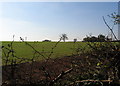
2
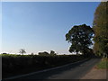
Green Lane
This side of the hedge Coventry suburb. On the other side, Warwickshire farmland.
Image: © E Gammie
Taken: 14 Oct 2011
0.14 miles
3
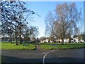
Finham Green Road and Droylsdon Park Road
Finham Green Road circles round to the south, Droylsdon Park Road to the north and they both meet up again on the far side of the green. The footpath takes the short-cut across.
Image: © E Gammie
Taken: 31 Dec 2020
0.17 miles
4
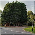
The Streisand Effect
Planting a screen of fast-growing leylandii trees to screen the garden serves to draw attention to it and makes passers-by wonder what lies beyond. This is an example of the Streisand Effect, named after Barbra Streisand's attempts to have an aerial photo of her clifftop California mansion removed from a website documenting coastal erosion, attempts which had the perverse effect of publicising the photo.
The hedge can be seen at the junction of Green Lane and St Martin's Road, on the southern tip of Coventry. On the Streisand Effect see Wikipedia https://en.m.wikipedia.org/wiki/Streisand_effect .
Image: © A J Paxton
Taken: 19 Aug 2023
0.18 miles
5
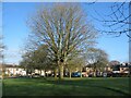
Droylsdon Park Road
Droylsdon Park Road circles round the northern edge of a small green with trees.
Image: © E Gammie
Taken: 31 Dec 2020
0.18 miles
6
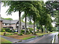
Green Lane, Finham
These large houses are at the southern end of Green Lane overlooking open country on the south side of Coventry.In the distance is the junction of Green Lane and St Martins Rd with Kings Hill on the right.
Image: © Nigel Mykura
Taken: 14 Aug 2010
0.19 miles
7
Coventry Boundary
Approaching Finham on the road from Stoneleigh.
Image: © David Stowell
Taken: 23 Jul 2005
0.21 miles
8
A46 Bridge, Finham
The bridge carrying the A46 over the old Coventry - Leamington Spa road at Finham.
Image: © David Stowell
Taken: 23 Jul 2005
0.21 miles
9
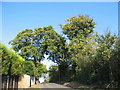
The summit of Howes Lane
Howes Lane (B4115) forms part of Coventry city boundary. Here it crosses a low ridge that juts out between the river Sowe and Finham brook. The oak trees are a reminder of its former rural nature but beyond the hedgerow on the right traffic roars by on the A46 bypass.
Image: © E Gammie
Taken: 14 Oct 2011
0.22 miles
10
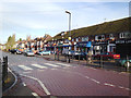
Shops and Post Office, Green Lane, Finham, Coventry
As well as the local shops there are two schools on Green Lane. The road is traffic-calmed, with a mandatory 20mph speed limit in places.
Image: © Robin Stott
Taken: 17 Dec 2012
0.23 miles