IMAGES TAKEN NEAR TO
Fenside Avenue, COVENTRY, CV3 5QJ

Introduction

This page details the photographs taken nearby to Fenside Avenue, CV3 5QJ by members of the Geograph project.

The Geograph project started in 2005 with the aim of publishing, organising and preserving representative images for every square kilometre of Great Britain, Ireland and the Isle of Man.

There are currently over 7.5m images from over14,400 individuals and you can help contribute to the project by visiting https://www.geograph.org.uk

Image Map


Images are licensed for reuse under creativecommons.org/licenses/by-sa/2.0
Notes
  • Clicking on the map will re-center to the selected point.
  • The higher the marker number, the further away the image location is from the centre of the postcode.

Image Listing (20 Images Found)

Images are licensed for reuse under creativecommons.org/licenses/by-sa/2.0
Image
Details
Distance
1
Stopped traffic on the Stivichall roundabout
Roadworks are being undertaken on the eastbound sliproad, causing the roundabout itself to be at a standstill.
Image: © Bill Boaden Taken: 26 Jun 2015
0.05 miles
2
Sliproad off Stonebridge Highway
The traffic is at a complete standstill here, due to the roundabout ahead being full. The roundabout is the junction of the A45 and A46.
Image: © Bill Boaden Taken: 26 Jun 2015
0.08 miles
3
Fenside bus turning circle
This turning circle, on Fenside Avenue just east of its junction with Charminster Drive, is no longer in use as the buses serving Fenside now operate in a loop around the estate.
Image: © Richard Vince Taken: 10 Nov 2012
0.11 miles
4
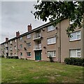
Mass-produced housing: Blocks of flats, Fred Lee Grove
These three-storey blocks on the Stonebridge estate on the southern edge of Coventry were built in 1950-51 by Wimpey to the designs of the City Architect's Department under Donald Gibson. See Image] for more information. In the words of Jeremy & Caroline Gould, "The monotony... was disappointing and the experiment proved that, since the houses were architecturally modest, it would require imaginative layout, varied density and a richer landscape to make distinctive places." See their e-book, 'Coventry, the making of a modern city 1939-73', p84, at the Historic England site https://historicengland.org.uk/images-books/publications/coventry-making-of-modern-city-1939-73/ . How many volume housebuilders today would even attempt to make 'distinctive places'?
Image: © A J Paxton Taken: 29 Aug 2023
0.11 miles
5
Confused bus, Charminster Drive, Fenside
This Mercedes O.405N, operated by National Express Coventry, appears to know where it's going, but seems confused about how to get there. "City Centre via Cheylesmore" would be more appropriate.
Image: © Richard Vince Taken: 10 Nov 2012
0.12 miles
6
Allotment area
Near the A45/A46 junction.
Image: © James Allan Taken: 7 Jun 2014
0.13 miles
7
Block of flats on Gregory Hood Road, the Stonebridge Estate
These council flats were built in 1950-51 by Wimpey, using the 'no fines' method (concrete without fine, sandy aggregates, a cheaper method of building) for the Coventry City Architect's Department under Donald Gibson. See Image] for further information.
Image: © A J Paxton Taken: 29 Aug 2023
0.13 miles
8
Stonebridge Highway looking west
Image: © Colin Pyle Taken: 27 Feb 2012
0.13 miles
9
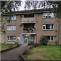
Entrance to flats on Gregory Hood Road, Coventry
This is a close up of an entrance to the flats depicted at Image The glazed tiles with flat numbers and a pastel-shaded surround (a different colour for each entrance) are details that show care and concern for tenants and their environment. These flats date from 1950-51; later on, pressure on the council to build fast and cheap would lead to the shoddiness seen, for example, at Image
Image: © A J Paxton Taken: 29 Aug 2023
0.14 miles
10
View of the A46
Image: © Dave Thompson Taken: 6 Jan 2021
0.14 miles