IMAGES TAKEN NEAR TO
Friary Close, WARWICK, CV35 8TD
Introduction
This page details the photographs taken nearby to Friary Close, CV35 8TD by members of the Geograph project.
The Geograph project started in 2005 with the aim of publishing, organising and preserving representative images for every square kilometre of Great Britain, Ireland and the Isle of Man.

There are currently over 7.5m images from over14,400 individuals and you can help contribute to the project by visiting https://www.geograph.org.uk
Image Map
Images are licensed for reuse under creativecommons.org/licenses/by-sa/2.0
Notes
- Clicking on the map will re-center to the selected point.
- The higher the marker number, the further away the image location is from the centre of the postcode.
Image Listing (18 Images Found)
Images are licensed for reuse under creativecommons.org/licenses/by-sa/2.0
Image
Details
Distance
1
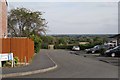
Mayne Close, Hampton Magna
Hampton Magna is sited on the rim of the Avon valley so some properties enjoy stunning views. The public footpath from here is reportedly an old route between Warwick and neighbouring Hampton on the Hill.
Image: © Robin Stott
Taken: 1 Oct 2009
0.06 miles
2
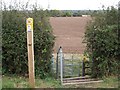
New furniture!
Start of a footpath from Mayne Close, Hampton Magna, towards Warwick but here looking towards Leasowes Farm Image
Image: © Robin Stott
Taken: 8 Oct 2009
0.06 miles
3
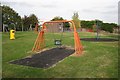
Play area and utility compound, Chichester Avenue, Hampton Magna
Image: © Robin Stott
Taken: 1 Oct 2009
0.09 miles
4
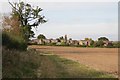
South-east edge of Hampton Magna village
Image: © Robin Stott
Taken: 1 Oct 2009
0.12 miles
5
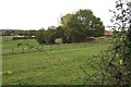
Former rifle range near Hampton Magna
I'm asserting this confidently but it is presumption. Within the trees is a massive brick wall, with mounds to the right. It isn't a building and it is near a former barracks, so…
Image: © Robin Stott
Taken: 8 Oct 2009
0.13 miles
6
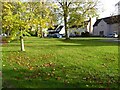
Houses on Montgomery Avenue
Houses on Montgomery Avenue in Hampton on the Hill.
Image: © Philip Halling
Taken: 31 Oct 2022
0.14 miles
7
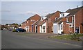
Cherry Lane, Hampton Magna
Although altered and adapted, these are some of the original houses from the redevelopment of Budbrooke Barracks in the late 1960s and early 1970s. Brick boxes they were not. Characteristic features were the upstanding gable ends and slot windows, both horizontal and vertical.
Image: © Robin Stott
Taken: 1 Oct 2009
0.14 miles
8
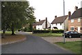
Montgomery Avenue, Hampton Magna
A group of former army houses set apart from the rest of the Budbrooke Barracks site. Spaces have been filled with more houses in recent years. A footpath forms a shortcut into Hampton on the Hill.
Image: © Robin Stott
Taken: 1 Oct 2009
0.14 miles
9
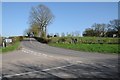
Road junction near Hampton on the Hill
Image: © Philip Halling
Taken: 18 Apr 2018
0.17 miles