Cherry Lane, Hampton Magna
Introduction
The photograph on this page of Cherry Lane, Hampton Magna by Robin Stott as part of the Geograph project.
The Geograph project started in 2005 with the aim of publishing, organising and preserving representative images for every square kilometre of Great Britain, Ireland and the Isle of Man.

There are currently over 7.5m images from over 14,400 individuals and you can help contribute to the project by visiting https://www.geograph.org.uk
Cherry Lane, Hampton Magna
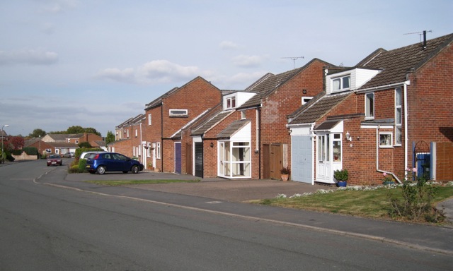
Image: © Robin Stott Taken: 1 Oct 2009
Although altered and adapted, these are some of the original houses from the redevelopment of Budbrooke Barracks in the late 1960s and early 1970s. Brick boxes they were not. Characteristic features were the upstanding gable ends and slot windows, both horizontal and vertical.
Images are licensed for reuse under creativecommons.org/licenses/by-sa/2.0
Image Location
Latitude
52.281652
Longitude
-1.626169