
IMAGES TAKEN NEAR TO
Barber Walk, WARWICK, CV35 8SG
Introduction
This page details the photographs taken nearby to Barber Walk, CV35 8SG by members of the Geograph project.
The Geograph project started in 2005 with the aim of publishing, organising and preserving representative images for every square kilometre of Great Britain, Ireland and the Isle of Man.

There are currently over 7.5m images from over14,400 individuals and you can help contribute to the project by visiting https://www.geograph.org.uk
Image Map
Images are licensed for reuse under creativecommons.org/licenses/by-sa/2.0
Notes
- Clicking on the map will re-center to the selected point.
- The higher the marker number, the further away the image location is from the centre of the postcode.
Image Listing (18 Images Found)
Images are licensed for reuse under creativecommons.org/licenses/by-sa/2.0
Image
Details
Distance
1
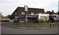
The Monty, Hampton Magna
It opened in 1972 as the About Time because it took so long to get built. The Montgomery of Alamein name connects with the site's military past. Enjoy a Full Monty breakfast, 11-2 Saturdays, £4-50. On the left is the community centre.
Image: © Robin Stott
Taken: 1 Oct 2009
0.02 miles
2
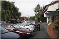
Slade Hill, Hampton Magna
The fair trade shop-cum-café, sponsored by the church, was enjoying good after-school patronage as I passed. The postbox ID is CV35 146.
Image: © Robin Stott
Taken: 1 Oct 2009
0.02 miles
3
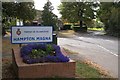
Old Budbrooke Road
At its junction with Blandford Way
Image: © Robin Stott
Taken: 1 Oct 2009
0.16 miles
4
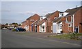
Cherry Lane, Hampton Magna
Although altered and adapted, these are some of the original houses from the redevelopment of Budbrooke Barracks in the late 1960s and early 1970s. Brick boxes they were not. Characteristic features were the upstanding gable ends and slot windows, both horizontal and vertical.
Image: © Robin Stott
Taken: 1 Oct 2009
0.16 miles
5
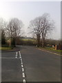
A view towards St Michael's Church, Budbrooke from Hampton Magna
A view towards St Michael's Church, Budbrooke from Hampton Magna
Image: © Anthony Morgan
Taken: 21 Mar 2009
0.19 miles
6
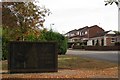
Commemorative wall, Blandford Way, Hampton Magna
It reads "Site of Budbrooke Barracks 1877-1960". The emblem to the left is of the Royal Warwickshire Regiment. Arras Boulevard continues up the hill.
Image: © Robin Stott
Taken: 1 Oct 2009
0.20 miles
7
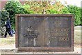
Commemorative wall, Blandford Way, Hampton Magna
The wall is set at the back of a simple circle of brick paving.
Image: © Robin Stott
Taken: 1 Oct 2009
0.20 miles
8
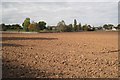
Budbrooke Primary School playing field, Hampton Magna near Warwick
The houses on the right are to the rear of Arras Boulevard - one of several streets on the former Budbrooke Barracks site named after First World War battles.
Image: © Robin Stott
Taken: 8 Oct 2009
0.21 miles
9
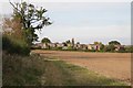
South-east edge of Hampton Magna village
Image: © Robin Stott
Taken: 1 Oct 2009
0.21 miles
10

Pasture on the site of medieval village
Image: © Philip Jeffrey
Taken: 4 May 2025
0.23 miles