
IMAGES TAKEN NEAR TO
Wedgnock, WARWICK, CV35 7PX
Introduction
This page details the photographs taken nearby to CV35 7PX by members of the Geograph project.
The Geograph project started in 2005 with the aim of publishing, organising and preserving representative images for every square kilometre of Great Britain, Ireland and the Isle of Man.

There are currently over 7.5m images from over14,400 individuals and you can help contribute to the project by visiting https://www.geograph.org.uk
Image Map
Images are licensed for reuse under creativecommons.org/licenses/by-sa/2.0
Notes
- Clicking on the map will re-center to the selected point.
- The higher the marker number, the further away the image location is from the centre of the postcode.
Image Listing (16 Images Found)
Images are licensed for reuse under creativecommons.org/licenses/by-sa/2.0
Image
Details
Distance
1
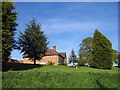
Prospect Farm
This farm, sat on the top of a small hill commands a splendid view across Warwick and Leamington Spa
Image: © David Stowell
Taken: 29 Apr 2005
0.01 miles
2
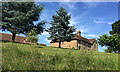
Prospect Farm, Wedgnock Lane, northwest of Warwick
The farmhouse is dated 1743 and is listed Grade II: https://historicengland.org.uk/listing/the-list/list-entry/1364958 The farm is in Wedgnock Old Park, once the northern deerpark of Warwick Castle. Photographed from Wedgnock Lane, a public bridleway.
Image: © Robin Stott
Taken: 11 Jun 2018
0.01 miles
4
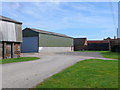
Buildings at Prospect Farm
A very neat and tidy modern farm with very little evidence of farming such as machinery lying round. It may just be residential now.
Image: © Nigel Mykura
Taken: 25 Mar 2012
0.03 miles
5
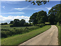
Approaching Prospect Farm, Wedgnock Old Park north of Warwick
This private road and public bridleway gives a gentle climb from the Avon valley on to the Arden plateau. Never named on maps it was probably the route from Warwick Castle, a continuation of Cape Road as a track into its northern deer park, now shown on maps as Wedgnock Old Park. Today it leads to Prospect Farm, Deer Park Farm and Bulloak Farm. To the east a rifle range is first shown on a map of 1905, perhaps from the time of the Boer War.
Image: © Robin Stott
Taken: 11 Jun 2018
0.04 miles
6
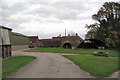
Prospect Farm
The prospect is of Warwick to the south-east, a couple of gridsquares away.
Image: © Robin Stott
Taken: 19 Nov 2009
0.07 miles
7
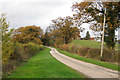
Lane climbs to Prospect Farm
The prospect is of Warwick to the south-east.
Image: © Robin Stott
Taken: 19 Nov 2009
0.07 miles
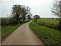
9
Semi-derelict farm buildings below Prospect Farm
The southern edge of Larch Covert is on the skyline, in square. On the right is a scrub-covered slope, part of the old Wedgnock rifle range, now used for paintball.
Image: © Robin Stott
Taken: 19 Nov 2009
0.08 miles
10
Bales stacked north-west of Prospect Farm
Image: © Robin Stott
Taken: 17 Nov 2009
0.11 miles