Prospect Farm, Wedgnock Lane, northwest of Warwick
Introduction
The photograph on this page of Prospect Farm, Wedgnock Lane, northwest of Warwick by Robin Stott as part of the Geograph project.
The Geograph project started in 2005 with the aim of publishing, organising and preserving representative images for every square kilometre of Great Britain, Ireland and the Isle of Man.

There are currently over 7.5m images from over 14,400 individuals and you can help contribute to the project by visiting https://www.geograph.org.uk
Prospect Farm, Wedgnock Lane, northwest of Warwick
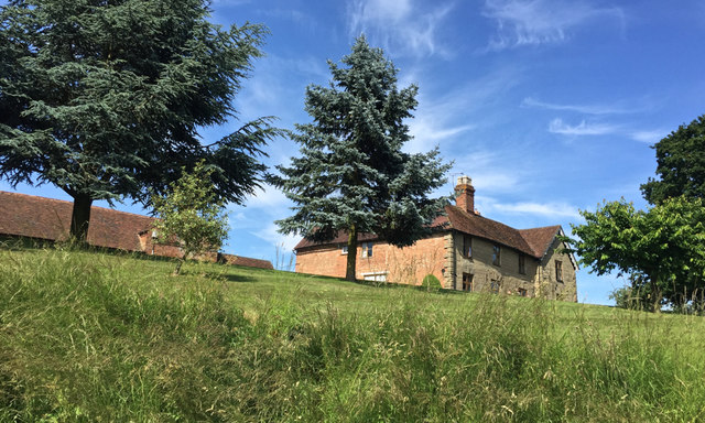
Image: © Robin Stott Taken: 11 Jun 2018
The farmhouse is dated 1743 and is listed Grade II: https://historicengland.org.uk/listing/the-list/list-entry/1364958 The farm is in Wedgnock Old Park, once the northern deerpark of Warwick Castle. Photographed from Wedgnock Lane, a public bridleway.
Images are licensed for reuse under creativecommons.org/licenses/by-sa/2.0
Image Location
Latitude
52.305595
Longitude
-1.607341