
IMAGES TAKEN NEAR TO
Stonebridge Highway, COVENTRY, CV3 4EJ
Introduction
This page details the photographs taken nearby to Stonebridge Highway, CV3 4EJ by members of the Geograph project.
The Geograph project started in 2005 with the aim of publishing, organising and preserving representative images for every square kilometre of Great Britain, Ireland and the Isle of Man.

There are currently over 7.5m images from over14,400 individuals and you can help contribute to the project by visiting https://www.geograph.org.uk
Image Map
Images are licensed for reuse under creativecommons.org/licenses/by-sa/2.0
Notes
- Clicking on the map will re-center to the selected point.
- The higher the marker number, the further away the image location is from the centre of the postcode.
Image Listing (13 Images Found)
Images are licensed for reuse under creativecommons.org/licenses/by-sa/2.0
Image
Details
Distance
1
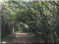
Path through a blackthorn thicket, Baginton Fields Nature Trail, Willenhall, Coventry
Baginton Fields is an enclave of scrub woodland bounded by playing fields, school grounds, and the heavily-used six-lane A45. The circular trail is signed as part of the Sowe Valley, though there is no link to the Sowe Valley Path.
Image: © Robin Stott
Taken: 5 Oct 2016
0.04 miles
2
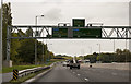
A45 near Tollbar End
Heading west at the southern edge of Coventry.
Image: © J.Hannan-Briggs
Taken: 13 Oct 2016
0.07 miles
4

Edgetech and Andantex, Stonebridge Trading Estate
Industrial units on the eastern side of Rowley Drive, near Tollbar End.
Image: © John Brightley
Taken: 20 Oct 2010
0.12 miles
5
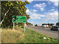
A45 Stonebridge Highway by Baginton Fields, southeast Coventry
The A45/M45 is a route between the M1, Coventry and Birmingham. This section is a busy link between two quite separate stretches of the A46. Over the brow is Tollbar End, a five-way junction notorious for holdups. Until recently it was a light-controlled double roundabout. Over many months (with even longer holdups) the junction has been remodelled as one large roundabout spanning an underpass for A46 traffic. The works were coming to an end at the time of the photo but the cones were still out in force. Baginton Fields is in part public open space with a nature trail. A gate out-of-shot left allows access to the cycleway/footpath, nearest the camera.
Image: © Robin Stott
Taken: 5 Oct 2016
0.12 miles
6
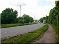
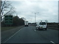
Stonebridge Highway, A45
Looking WSW near the Tollbar End roundabout.
Image: © David P Howard
Taken: 2 Jun 2010
0.13 miles
7
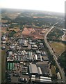
Stonebridge Industrial Estate, Baginton: aerial 2018
Image: © Chris
Taken: 30 Jun 2018
0.16 miles
8
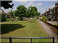
Green space between Sedgemoor Road and Sunnybank Avenue
A nice green space between the rows of houses. The council grass cutters were in the area, cutting and strimming, and had just done this patch.
Image: © David P Howard
Taken: 2 Jun 2010
0.19 miles
9
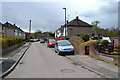
Sebastian Close, Willenhall, southeast Coventry
A later walk made it clear that this is made-up, level ground. Hard-to-find footpaths off this close and Sedgemoor Road drop sharply down to a grassy open space in the floodplain of the River Sowe.
Image: © Robin Stott
Taken: 30 Apr 2016
0.21 miles
10

Baginton
Old rolling stock close to the Midland Air Museum but a long way from any Railway.
Image: © Ian Rob
Taken: 5 Feb 2006
0.21 miles