
IMAGES TAKEN NEAR TO
Tonbridge Road, COVENTRY, CV3 4AX
Introduction
This page details the photographs taken nearby to Tonbridge Road, CV3 4AX by members of the Geograph project.
The Geograph project started in 2005 with the aim of publishing, organising and preserving representative images for every square kilometre of Great Britain, Ireland and the Isle of Man.

There are currently over 7.5m images from over14,400 individuals and you can help contribute to the project by visiting https://www.geograph.org.uk
Image Map
Images are licensed for reuse under creativecommons.org/licenses/by-sa/2.0
Notes
- Clicking on the map will re-center to the selected point.
- The higher the marker number, the further away the image location is from the centre of the postcode.
Image Listing (32 Images Found)
Images are licensed for reuse under creativecommons.org/licenses/by-sa/2.0
Image
Details
Distance
1
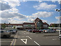
Asda supermarket, Whitley, Coventry
This supermarket (anti-clockwise) was recently converted from a Safeways and is built on the site of the former Whitley Hospital.
Image: © David Stowell
Taken: 15 Jul 2005
0.05 miles
2
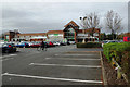
ASDA Abbey Park
This ASDA superstore in the Coventry suburbs appears to have changed little from the 2005 view: Image
Image: © Stephen McKay
Taken: 26 Oct 2014
0.14 miles
3
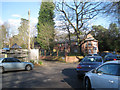
Junction of Abbey Road and Abbey Way, but no abbey, Whitley, Coventry
Signs say Willenhall by bike, right; Virgin Racquets Health Club, left (over Abbey Bridge).
Image: © Robin Stott
Taken: 17 Feb 2015
0.16 miles
4
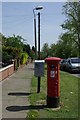
Street furniture in Abbey Road
The postbox is Georgian.
Image: © Keith Williams
Taken: 22 Apr 2009
0.19 miles
6

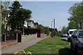
Shame they're not Banksy's
Graffiti on the rear on the Virgin Active building.
What colourful expression! These doors will probably be painted over rather than sold on for a great price.
Image: © Ian Paterson
Taken: 4 May 2016
0.20 miles
7
Whitley Bridge
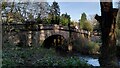
Sometimes known as Whitley Abbey Bridge (though there was never a monastery here), this bridge once carried the Coventry to London road over the River Sherbourne. It has long since been bypassed and is now blocked to motor traffic. It is Grade II listed and is dated to the 16th century by the listing at the Historic England site https://historicengland.org.uk/listing/the-list/list-entry/1076652?section=official-list-entry .
Image: © A J Paxton
Taken: 30 Mar 2024
0.20 miles
8
Car park and turning circle for two schools, Whitley, southeast Coventry
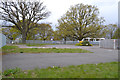
Whitley Abbey Primary School is ahead. The school out-of-shot left is signed at the Ashington Grove entrance as Alice Stevens School, which was a special needs mixed secondary school. It is not listed as a Coventry school. It appears to have been absorbed into the Riverbank Academy on Princethorpe Way, Binley. The buildings here are unlabelled on current mapping and are assumed to be closed.
It's interesting how the schools are set among mature oak and beech trees – presumably in the parkland of the former Whitley Abbey.
Image: © Robin Stott
Taken: 30 Apr 2016
0.20 miles
9
Lichen on north parapet, Whitley Abbey Bridge, Whitley, Coventry
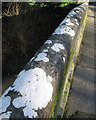
Perhaps Solenopsora candicans: "Frequent in England and Wales on limestone". The bridge was built between 1755 and 1765.
Image: © Robin Stott
Taken: 17 Feb 2015
0.20 miles
10
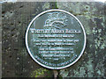
Plaque on Whitley Abbey Bridge, Whitley, Coventry
Placed in 2005 it marks 250 years since the building of the bridge commenced in 1755. It reads:
Whitley Abbey Bridge
Built between 1755 and 1765
'Many feet walked here in years past
and will do in years to come…'
Text by: Emma Stevenson (12)
Drawing by: Gary Piazzon (15)
Whitley Abbey School
2005
Whitley Local History Group
Image: © Robin Stott
Taken: 17 Feb 2015
0.20 miles