Whitley Bridge
Introduction
The photograph on this page of Whitley Bridge by A J Paxton as part of the Geograph project.
The Geograph project started in 2005 with the aim of publishing, organising and preserving representative images for every square kilometre of Great Britain, Ireland and the Isle of Man.

There are currently over 7.5m images from over 14,400 individuals and you can help contribute to the project by visiting https://www.geograph.org.uk
Whitley Bridge
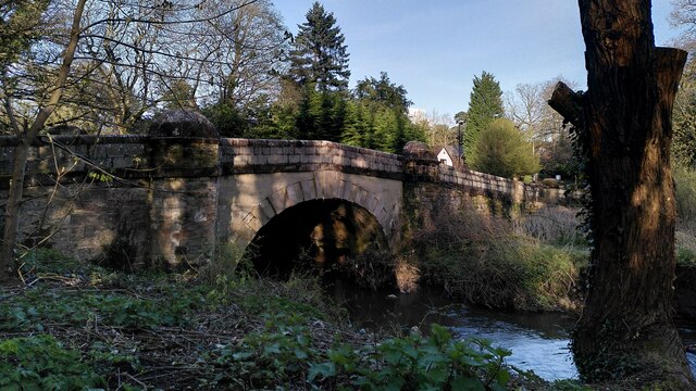
Image: © A J Paxton Taken: 30 Mar 2024
Sometimes known as Whitley Abbey Bridge (though there was never a monastery here), this bridge once carried the Coventry to London road over the River Sherbourne. It has long since been bypassed and is now blocked to motor traffic. It is Grade II listed and is dated to the 16th century by the listing at the Historic England site https://historicengland.org.uk/listing/the-list/list-entry/1076652?section=official-list-entry .
Images are licensed for reuse under creativecommons.org/licenses/by-sa/2.0
Image Location
Latitude
52.388349
Longitude
-1.489323